
Though a topo map is a handy thing to have in the field, gone are the days when a USGS map was the main tool for planning an outdoor excursion. So much more visual information is available today via sites like Google Earth and Microsoft Virtual Earth. Lately, I've been exploring some of these sites and learning to use their features.
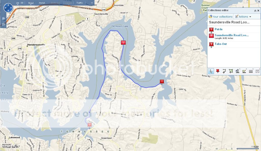
Here, for instance is a kayak paddle planned for Friday on Old Hickory Lake that I charted with Live Search Maps. Using the route feature, I was able to track a path that hugs the shore line and determine the paddle would be over 9 miles long.
The lake features can be viewed with a pretty fine-grained lens, either with an Aerial view as shown here at the put-in.

Or with a Bird's Eye view as shown here at the take-out.

I can also download this charted path as a .gpx file, label the various waypoints, and upload the route to my Garmin handheld should I need navigational assistance on the lake. Information can also go in the opposite direction if I want to save a track on my handheld and then view that track as plotted over an Aerial or Road view of the terrain. Another nice feature is that driving directions are readily called up to the take-out, to the put-in, or between the two.
In the past week or so, I've used Live Search Maps to create a couple of routes for upcoming paddles, and those routes are now loaded up on the Garmin after a bit of finagling with a freeware application called EasyGPS. One is a 20+ mile trip from the Mona launch on the Stones River up to the Anderson Public Use Area on Percy Priest. The other is a river float on the Painted Rock River down in Alabama. I am looking forward to those overnight paddles this summer.
The world is getting smaller and smaller, and our vantage points are getting more powerful all the time.
Update: Live Search Maps is now Bing maps.
No comments:
Post a Comment