 With snow still on the ground from Nasville's white Christmas, C and I decided to head over to Radnor State Park today and take a turn around the lake. As we drove in, we spotted four bucks and a doe off in the woods to the left of Otter Creek Road, and a couple of big bucks were among them. The two smaller bucks were fighting as a big six-point and an even bigger eight-point looked on. Once in the park, we saw ten more deer along our trail, putting the final tally at fifteen. Throughout our hike, the snow remnants made for nice scenery, especially from the west end of the lake where we stopped alongside the concrete barrier to take pictures and make a batch of hot chocolate. No matter where you are, hot cocoa is always a pleasure on a cold day, and C and I agreed that today was no exception.
Lake Hike at Snowy Radnor

Monday, December 27, 2010
Lake Hike at Snowy Radnor
Monday, December 20, 2010
Mossy Ridge at Percy Warner
 Jimmy and I headed over to Percy Warner for a late day hike of the Mossy Ridge Trail. This roughly 4.5 mile loop sits just north of the Warner Park Nature Center and crosses over a number of the ridges in that area. A really good step-by-step breakdown of Mossy Ridge can be found at cloudhiking.com. Close to Jimmy's new house, Mossy has become his home track of sorts. I, however, was hiking it for the first time fresh off a case of acute bronchitis. Hence, the trail kicked my butt. Going from inhaler to sharp elevation changes might not have been my brightest idea, but I still enjoyed the time outdoors, and we completed the round in about an hour and a half, making it back to our trailhead just as the woods were getting good and dark. Aside from my wheezing, trip highlights included snapping a Blair-Witch photo at the remains of an old cabin and traversing the ridgeline "Tornado Road" while spotting a few deer.
Mossy Ridge at Percy Warner
Thursday, November 25, 2010
Thanksgiving Week Hikes
 November 23: My beloved REI Elements rain jacket gave up the ghost after a run through the washing machine, and I was forced to get a replacement. On Tuesday, I headed out solo to try the new jacket (a Patagonia shell), and I wound up running into an old friend. Last year, I encountered a large eight-point buck on Ganier Ridge Trail. I didn't have a camera that day, but for the longest, I watched him browse about thirty feet away. When I finally decided to move on, he walked along beside me almost as though he wanted a handout. Finally, after about fifty yards, he sped up and cut across the trail in front of me. On Tuesday the 23rd, I saw him again, this time earlier in the trail but still in the same general vicinity. I watched him for a while, snapping some pics as he tracked off the ridge. A little further up, I ran across his "harem," two does browsing for food and playfully nudging each other. In all, I saw nine deer, including a little spike buck (see video below) and a buck and doe in flagrante delicto. Clearly, the rut was on in late November.
Thanksgiving Week - Hike 1 November 24: The next day, the Wednesday before Thanksgiving, C and I decided to head back to Radnor and make the same hike. It was downright rainy, and my new jacket got a real test, which it passed with flying colors. On our loop of Ganier Ridge, we only saw a couple of deer, but one of them was (I think) the same little spike buck from the day before. Near the end of the hike, C was getting cold because of the rain, so we decided to stop at one of the trailside benches and cook up some hot chocolate.
Thanksgiving Week - Hike 2
Monday, November 22, 2010
Harpeth Woods Trail Redux
With fall starting to fade, the family headed over to Edwin Warner State Park for a hike of the Harpeth Woods Trail. We made it around the near-three-mile loop in about two-and-a-half hours, but that time included a stop at the picnic area at the southern tip of the trail. There, we had snacks and drinks, and E reveled in her liberation from the child carrier. She had the best time playing on the small bridge nearby (see video below). At the end of our hike, C and E played in a designated children's area close to the park's Nature Center, and as an observer, I found the whole scene thought provoking. I recently read Richard Louv's Last Child in the Woods, a book that claims we're becoming a nature-deficit culture, and I was struck by two things about this playground. The first was that this "natural" space was still cordoned off by a log fence, ostensibly to keep children contained and somehow delineate the area as "safe." Louv writes about how children's play has become increasingly organized, circumscribed, and sanitized. The second noteworthy element involved how much fun the children had playing in and around a big lump of dirt, free of strictures about how they should play. This scenario supports core principles of Louv's book, which argues that children need unconstrained play in natural settings and that such play has important cognitive and social benefits.
Harpeth Woods Trail at Edwin Warner
Sunday, November 14, 2010
Savage Gulf Overnight Trip
 Saturday morning was devoted to Mr. C's soccer game, so Jimmy and I didn't hit the road until about 11 a.m. Originally, when we talked about hiking part of South Cumberland State Park, we'd considered covering the roughly 8.5 miles to Hobbs Cabin on day one. However, with limited daylight and an unfamiliar trail ahead of us, we aimed lower, instead shooting for the Dinky Line camp area about four miles in. To get to camp, we made our way up the east side of the Savage Day Loop (2.2 miles), took a right onto the North Rim Trail (0.3 miles), and then connected up with the North Plateau Trail (1.4 miles to camp). On the GPS capture below, our path on day one can be traced by starting next to State Hwy 111, following the track up the right-hand side, and reaching the thumbtack (waypoint) placed at the camp site.
Savage Gulf Trip
Click on the thumbtacks below for photos from those spots.
After registering at the Ranger Station for a site, we made good time to camp. On the way, we crossed several suspension bridges and wound our way through both low-lying foliage and more sparsely vegetated woods. We were a little disappointed to learn we'd be sharing the camping area with a Boy Scout troop, but we were at least able to secure the site furthest away from the noisy boys. We pitched tents quickly and set about scrounging for fire wood. Just down from our site, a 10" diameter fallen pine was perfect fire material, but I'd forgotten my saw, and the entire tree was a little tough to budge. Lesson learned on the saw.
Click photos to enlarge. Later, with fire blazing as we finished our dinners, we quickly found out why you should obey the carry-in/carry-out policy at South Cumberland. Yes, there are environmental concerns, but perhaps more immediately, the Rangers lurk. I'd already read on a discussion board that the park Rangers there tend to pop out of nowhere and even monitor the trails at night. Sure enough, just as one of the people in our party (hint: it wasn't me) decided to burn a Mountain House aluminum pouch, a Ranger waltzed out of the darkness and into our camp. After we showed our permit, Jimmy strategically stoked the fire while I attempted to engage the Ranger in conversation and hold his gaze. Meanwhile, the offending lasagna pouch continued to sizzle and flutter. We did procure some good intel about the next day's hike, and luckily, we weren't issued a warning or ticket for a flagrant fire violation.
 The night brought rain, and in the morning, we had to forego a leisurely breakfast in lieu of a quick pack-up. Slurping down water and scarfing energy bars, we cut west across the short Mountain Oak Trail which connects the North Plateau Trail to the North Rim Trail. Based on the Ranger's information, we were expecting spectacular scenes right away, but it wasn't to be. Fog had rolled in with the rain, and visibility was severely limited. As we traced the North Rim Trail southward, we began to wonder if we were going to see down into the Gulf at all.
 In a number of spots, the North Rim Trail bumps up to the bluffs and allows for sightseeing into the Gulf. Finally for us, the fog lifted, and we were treated to some great scenery of the canyon, its rugged cliffs, and the late fall foliage. Though the wet weather made the rocky outcroppings slicker than usual, we edged out to a number of overlooks and took in some amazing panoramic views. One particularly excellent vista held a plaque noting how Samuel H. Werner and his wife Ellen Young Werner bought 3800 acres of the land in 1924 and protected it until it became a state natural area in 1974. To this monument, I would like to add a postscript: thank you, Samuel and Ellen.
With the same scene as a focus, Robert H. Mohlenbrock's "Through the stone's door" (Natural History, November 2002) traces the early development of South Cumberland's geology and provides a taxonomical breakdown of its flora. Mohlenbrock writes:
Viewed from the air, Savage Gulf looks like a giant footprint, with five deep canyons radiating from a central point. The canyons—or gulfs, as the local people call them—are each about five miles long and 800 feet deep and are rimmed almost continuously by sheer sandstone cliffs. ... Savage Gulf has been carved out by the Collins River as well as by Big Creek and Savage Creek. All these streams flow underground in places, though when the rain gets heavy, excess water is forced across the surface. Many miles of trails give hikers access both to the top of the plateau and to the streams below; several trails lead to overlooks of scenic waterfalls.
 Our hike took us past one such waterfall, Savage Falls, so we dutifully trekked down a side path to the designated vantage point. My first reaction was that it wasn't very savage (see video below); only a thin stream of water cascaded off the rock face, though I imagine that more flow could make Savage Falls an impressive display. However, since Savage Creek looked inviting and since I needed more water, we decided to detour onto the South Rim Trail and visit the creek and falls up close. I rocked hopped down Savage Creek while Jimmy followed the trail down to the falls, where we snapped a number of pictures and enjoyed the rocky scenery.
Sunday, October 24, 2010
Radnor Lake Loop
The whole family made it over to Radnor Lake State Park this afternoon. Though our initial plan was to hike just the South Lake Trail, the day was so pleasant that we decided to detour back around the lake. We wound up hiking for about two hours and covered 3.3 miles. The fall leaves were starting to put on a show and offered up some spectacular vistas—especially from the dam end of the lake.
Click pictures to enlarge.

Radnor Lake Loop
Monday, October 18, 2010
Little Loop at Radnor
Weather was such that we had to get outside today, so I took C and E for a short jaunt at Radnor. We hiked a small .9-mile loop that took us from the east parking lot down the lakeside road and then into the woods and back along the Ganier Ridge connector.
Our deer count for the day was ten, though we passed a lady on the trail who'd seen 21. C spotted one on the drive in, we saw four on the trail, and then five more stood by the road as we exited the park. E looked at the trailside deer with interest but took their presence in stride. She may have thought they were big dogs. She also did some singing in the backpack (click for mp3), something that C used to do when I carried him on hikes.

Little Loop at Radnor
Sunday, October 17, 2010
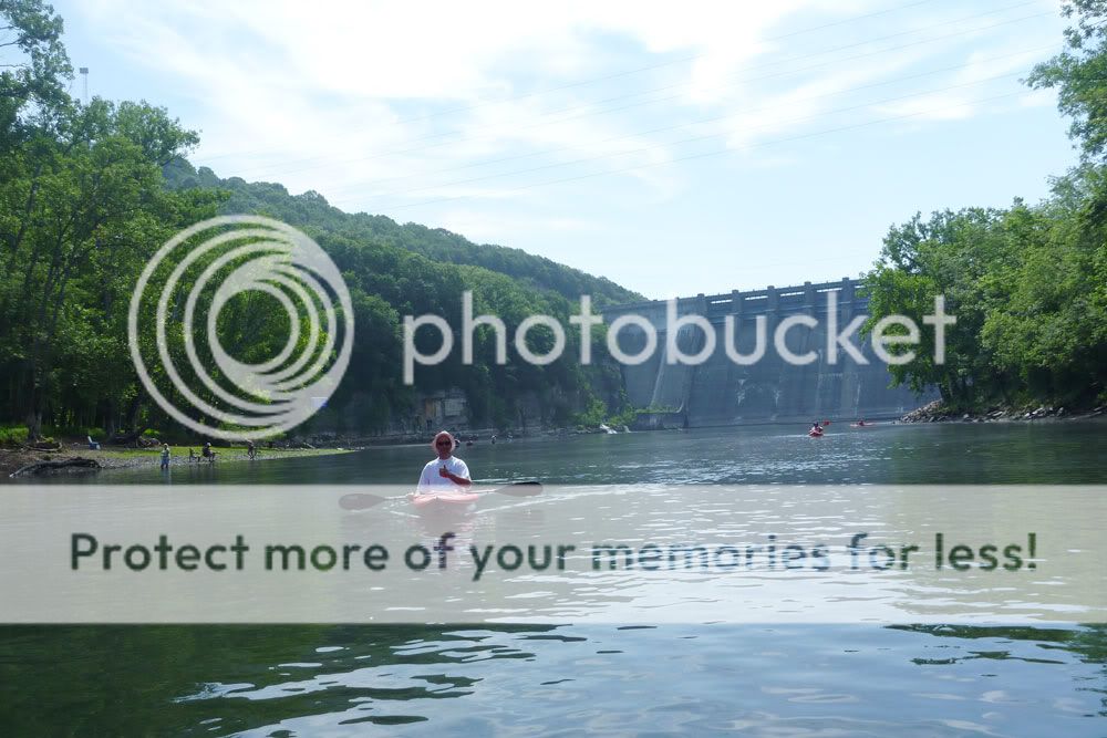
Low and Slow on the Harpeth River
Advanced Technical Draddling: A Style Primer
Jimmy and I knew the Harpeth was low. It has barely rained in middle Tennessee in more than a month. Still, after two decent rainfalls in the past week, I pushed for a Harpeth run yesterday morning. Turns out though it was less of a run and more of a drag. Or draddle, which is our newly coined portmanteau combining drag and paddle.
We retraced a route taken back in June of '09, and right off the bat, I feared we were going to have a repeat of the infamous draddle on the East Fork of the Stones a couple of years back. We didn't get a mile before the low flow necessitated an exit-and-drag maneuver. But then for much of the ~8.5-mile float, we managed to stay in our yaks—occasionally scraping bottom but managing to keep forward motion.
Hwy 249 to Hwy 70 on the Harpeth
Toward the end of the float, however, low current led to some pretty decent draddling. To avoid walking, we practiced techniques such as the paddle pole, the booty scoot, the bobsled, and the ever popular school of momentum. Still, we had to exit and drag in some stretches, and our two-hour float turned into 3.5 hours. Jimmy has since located hydrologic data for that section of the river, and using Saturday's level (1 foot) as a reference point, we should be able to avoid future draddling on the Harpeth.
Wildlife sightings included a fox squirrel, gobs of turkey vultures, at least four huge red-tailed hawks, and two coyotes. The 'yotes popped out of some tall grass next to a river bend, eyed us for a few seconds, and then trotted off downstream. I only captured the tail-end of one coyote with my camera, but Jimmy snapped a nice picture of both.
GEAR NOTES
Just a couple of items worth mentioning...
- I tried out my Seals spray skirt on the Perception Swifty and found it to be a good fit. It should be a valuable addition in cold and/or rainy weather and in active current where splashes are more likely.
- Soon after executing a draddle during which I tucked my GPS into my life vest, I looked to my right and saw a familiar pouch floating down the river. It contained, of course, my Garmin GPS, and I can now say with confidence that I appreciate the buoyancy of the dry pouch—a Seal Line "See Pouch." Without it, my Garmin unit might still be somewhere in the Harpeth.
Wednesday, August 11, 2010
Extreme Kayaking
Okay not really. But it was extremely hot kayaking.
Team Essence, middle-Tennessee's premier militant sea-kayaking organization, re-traced a route taken way back in May '09, paddling Old Hickory Lake from the Cedar Creek Recreation Area west to the Shute's Branch Recreation Area. We knew we were in for a treat when we stepped in the lake to launch and it felt like tepid bath water. With temperatures in the 90's and humidity at about 174%, paddling was brutal. Heck, movement was brutal. Normal protocol, when faced with such conditions, involves a shade tree, a hammock, and a large glass of iced-tea. Last year, we ran the approximately nine-mile stretch in 2 1/4 hours, but today it took us a half-hour longer. More stops for water. More stops for shade. More time to contemplate baby Jesus as the threat of heat stroke loomed larger.
And people wonder why we tend to do things slower here in the South.
Click pictures to enlarge.

One positive outcome was that I finally got close enough to see and photograph more clearly the mysterious water birds mentioned in two past posts (here and here). The birds are... drum roll please... double-crested cormorants! How satisfying to finally put that one to bed. Click this sentence for all you'll probably ever want to know about double-crested cormorants. In retrospect, I realize that my past identification difficulties stemmed from searching mainly cranes and herons as keywords.
Speaking of crested birds... we began our paddle alongside a couple of white ducks, and one of them looked like Wolfgang Amadeus Mozart as played by Tom Hulce. I mean, the dude duck was obviously wearing a piece to impress his lady friend. Turns out though that it was just a crested white duck, bred to have plumage atop its head. Neither Jimmy nor I snagged a close-up pic of the duck, but below is a close approximation taken from Google Images.


Monday, August 9, 2010
What's in a Name?
Well, not much when you're scrambling to find a name for your weblog and every URL under the sun seems taken. But the name wildwoodstream finally struck in epiphanic fashion, and I liked it immediately—even moreso when Blogger reported it was available.
Where did it come from? I honestly don't know. Pushed, I'd probably claim that it's a subconscious echo of "Wildwood Flower," a traditional song that dates all the way back to 1860, but a song most commonly associated with the Carter Family. Whatever the case, the name does evoke the images I'd like it to. Untamed spaces of wood and water have always been a part of my center and spirit. They sustain, recharge, and glorify. They have substance. They matter.
Curious, I Googled the phrase yesterday and was surprised to see the name Tolkien pop up. Reading further, I found that J.R.R. Tolkien's usage of "wild-wood stream" makes it all the more appropriate for a blog devoted to outdoor pursuits. The phrase appears in a song sung by Treebeard the Ent, one of the most potent symbols of nature, ecology, and conservation in all of Lord of the Rings. The Ents, of course, are the giant race of tree-herders who resemble their flocks. And according to the LOTR Wiki,
"The Ent and the Entwife" is an Elvish song that Treebeard sings to Meriadoc Brandybuck and Peregrin Took. It is about the Ents' desire that their wives come back to them, and the prophecy that that they might find a land where both Ents and Entwives can be happy together, though this will only be found after both have lost everything. The verses alternate points-of-view between the Ent and the Entwife. Several lines from the Ent's point-of-view are recited by Treebeard to Merry and Pippin as he takes them to his home in The Two Towers (film).In the opening stanza of "The Ent and the Entwife," the Ent persona sings,
When Spring unfolds the beechen leaf, and sap is in the bough;Beautiful. And fitting. Oftentimes, there's more to a name than you first think.
When light is on the wild-wood stream, and wind is on the brow;
When stride is long, and breath is deep, and keen the mountain-air,
Come back to me! Come back to me, and say my land is fair!
.
Friday, August 6, 2010
Gear Notes - Hiking Shoes, CamelBaks, Lizard Skins Tube Insulator, capCAP, Maratac AA Flashlight, Light My Fire Titanium Spork
For a while now, I've intended to put up some thoughts on a variety of products for the trail. While more extensive reviews may be forthcoming, below are some initial impressions about the items. Each thumbnail image, when clicked, leads to an enlarged photo.
A Tale of Two Hiking Shoes This past spring, I picked up a pair of Keen Siskiyou hiking shoes. I always have to debate 12's and 13's when I shop for footwear, and the size-13 Keens slipped horribly even when cinched tight around thick hiking socks. As a result, I wound up purchasing the 12's which I thought to be fine because of the wide toe bed particular to Keens. Unlike a lot of 12's, these shoes did not pinch my toes. I'd read good reviews regarding the comfort of Keens, and in the store, the shoes felt great. Indeed, for about a month thereafter, they worked out well in a casual, everyday capacity. But on May 20, I hiked Ganier Ridge with my son and found the shoes to be unfit for the trail. Best I can tell, the problem stems from two factors. First, the top lace holders (nylon loops instead of eyelets) sit far enough south that my foot can shift forward before the laces catch. Second, because I bought the 12's instead of the 13's, I have less toe space to spare. The on-trail result was/is painful, stubbed toes. Coming down from Ganier Ridge, no matter how tightly I laced, every step resulted in slippage and toes bumping the end of the shoe. The lessons here? (1) Test all hiking shoes using an incline before purchasing, and (2) if a purchase is at all questionable, "keep it in the co-op." This last bit roughly translates as: buy from REI where 100% satisfaction is standard policy. Since I couldn't return the Keens, I still have them, but they've been relegated to sidewalk duty. This past spring, I picked up a pair of Keen Siskiyou hiking shoes. I always have to debate 12's and 13's when I shop for footwear, and the size-13 Keens slipped horribly even when cinched tight around thick hiking socks. As a result, I wound up purchasing the 12's which I thought to be fine because of the wide toe bed particular to Keens. Unlike a lot of 12's, these shoes did not pinch my toes. I'd read good reviews regarding the comfort of Keens, and in the store, the shoes felt great. Indeed, for about a month thereafter, they worked out well in a casual, everyday capacity. But on May 20, I hiked Ganier Ridge with my son and found the shoes to be unfit for the trail. Best I can tell, the problem stems from two factors. First, the top lace holders (nylon loops instead of eyelets) sit far enough south that my foot can shift forward before the laces catch. Second, because I bought the 12's instead of the 13's, I have less toe space to spare. The on-trail result was/is painful, stubbed toes. Coming down from Ganier Ridge, no matter how tightly I laced, every step resulted in slippage and toes bumping the end of the shoe. The lessons here? (1) Test all hiking shoes using an incline before purchasing, and (2) if a purchase is at all questionable, "keep it in the co-op." This last bit roughly translates as: buy from REI where 100% satisfaction is standard policy. Since I couldn't return the Keens, I still have them, but they've been relegated to sidewalk duty.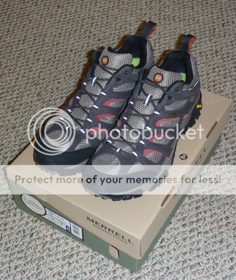 After purchasing the Keens, I donated my faithful old North Face hiking shoes (which had served me well in five different countries) to Goodwill. So... after the Ganier Ridge & Keen fiasco, I had no hiking shoes that I would actually use on trails. For a while, I tried to spot a good shoe deal online, but I finally settled on a pair at my local REI brick and mortar, which offered 20% off one item as well as a sale on Superfeet insoles. The shoes, Merrell Moab Gore-Tex XCR's, possess several features I like. For instance, they have Vibram outsoles, which are the equivalent of Michelin tires when it comes to hiking shoes/boots. Vibrams offer fantastic wear resistance and good traction at the same time. In addition, though the Merrells do utilize lace loops, the top two lace holders are eyelets which allow me to tighten the fit more than with the Keens. Finally, the Merrells offer a waterproof GoreTex upper. Already, I've taken these shoes into spots with high, wet grass, and they worked as advertised—keeping my feet dry and comfortable. After purchasing the Keens, I donated my faithful old North Face hiking shoes (which had served me well in five different countries) to Goodwill. So... after the Ganier Ridge & Keen fiasco, I had no hiking shoes that I would actually use on trails. For a while, I tried to spot a good shoe deal online, but I finally settled on a pair at my local REI brick and mortar, which offered 20% off one item as well as a sale on Superfeet insoles. The shoes, Merrell Moab Gore-Tex XCR's, possess several features I like. For instance, they have Vibram outsoles, which are the equivalent of Michelin tires when it comes to hiking shoes/boots. Vibrams offer fantastic wear resistance and good traction at the same time. In addition, though the Merrells do utilize lace loops, the top two lace holders are eyelets which allow me to tighten the fit more than with the Keens. Finally, the Merrells offer a waterproof GoreTex upper. Already, I've taken these shoes into spots with high, wet grass, and they worked as advertised—keeping my feet dry and comfortable. |
| The Camel's Two Humps Early in the life of this blog, I posted a review of the CamelBak Blowfish. Since then, I've added two more CamelBak packs to my stable. Both are 2009 models which, in CamelBak terms, means that colors and styling may have changed. It also means that I was able to get the packs at discount prices rather than retail. The packs have been "upgraded" with a CamelBak Big Bite Valve Cover and a Lizard Skins tube insulator (see next entry). Both feature OMEGA reservoirs with CamelBak's lifetime warranty as well as sternum straps and air mesh back panels. 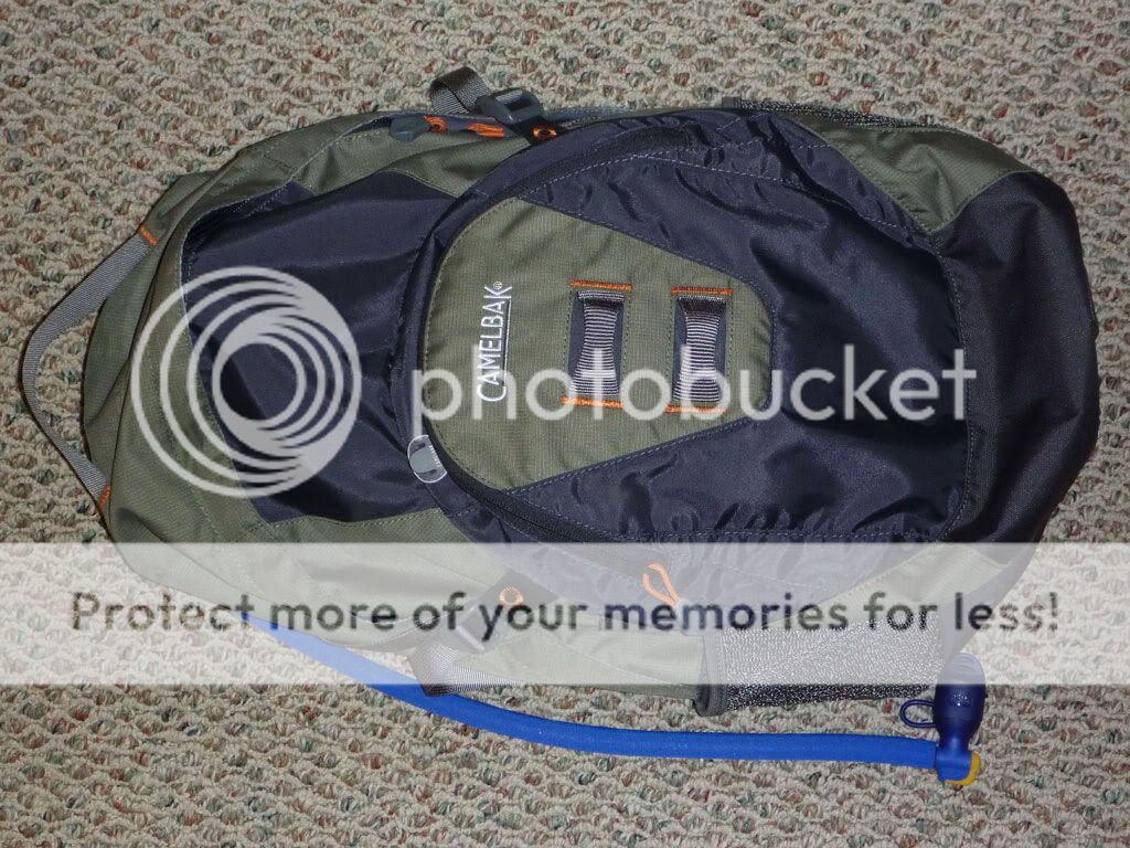 The first is the Cloud Walker, which comes with a 70-ounce (2.1 liter) reservoir, a spacious main compartment, and a smaller organization space. The reservoir loads into a separately zippered, insulated section on the back of the pack. Overall cargo capacity is 1340 cubic inches, which makes the Cloud Walker a good choice for a day pack. I recently used the pack while helping the Nashville Meetup group clean the Volunteer Trail at Long Hunter State Park. The pack comfortably carried in everything I needed, and the 2L of water gave some respite from the oppressively humid heat. The first is the Cloud Walker, which comes with a 70-ounce (2.1 liter) reservoir, a spacious main compartment, and a smaller organization space. The reservoir loads into a separately zippered, insulated section on the back of the pack. Overall cargo capacity is 1340 cubic inches, which makes the Cloud Walker a good choice for a day pack. I recently used the pack while helping the Nashville Meetup group clean the Volunteer Trail at Long Hunter State Park. The pack comfortably carried in everything I needed, and the 2L of water gave some respite from the oppressively humid heat.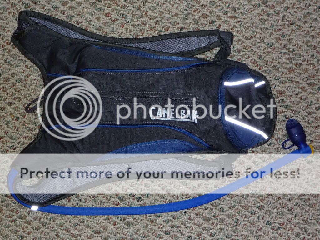 The second pack is the Fairfax, which is billed as a low-profile training option for running and mountain biking. Mr. C and I found this version at REI while looking for a hydration pack that would fit his frame. CamelBak does offer kids models like the Skeeter and the Mini M.U.L.E. However, we found that the Fairfax fit well with the shoulder straps cinched tight, and an advantage of the pack is that he can let out the straps as he grows. However, the price tag, at nearly $50, was a deal breaker. Google Shopping came through for me though, and I found the pack on closeout at one retailer for just $20. At that price, I went ahead and bought a Fairfax for each of us. The pack features a 50-ounce (1.5 liter) reservoir, and 130 cubic inches of storage for things like keys, wallet, bike tool, energy bars, etc. Like the Cloud Walker above, the Fairfax has an insulated reservoir compartment that helps keep water cool. Already, I've used mine on a day hike around Couchville Lake as well as on some runs around my neighborhood. The second pack is the Fairfax, which is billed as a low-profile training option for running and mountain biking. Mr. C and I found this version at REI while looking for a hydration pack that would fit his frame. CamelBak does offer kids models like the Skeeter and the Mini M.U.L.E. However, we found that the Fairfax fit well with the shoulder straps cinched tight, and an advantage of the pack is that he can let out the straps as he grows. However, the price tag, at nearly $50, was a deal breaker. Google Shopping came through for me though, and I found the pack on closeout at one retailer for just $20. At that price, I went ahead and bought a Fairfax for each of us. The pack features a 50-ounce (1.5 liter) reservoir, and 130 cubic inches of storage for things like keys, wallet, bike tool, energy bars, etc. Like the Cloud Walker above, the Fairfax has an insulated reservoir compartment that helps keep water cool. Already, I've used mine on a day hike around Couchville Lake as well as on some runs around my neighborhood. |
Lizard Skins Tube Insulator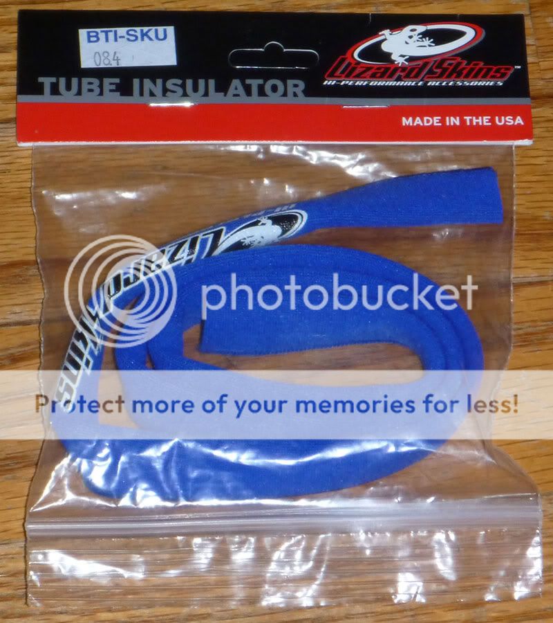 In a past post, I briefly mentioned the Lizard Skins tube insulator in conjunction with my first CamelBak pack. It is simply a neoprene sleeve that fits over the reservoir's drinking tube. If you've ever used a CamelBak on hot days, you will understand the beneficial utility of this device. Without any insulation, water inside the tubing warms up after a short while because of exposure to outside heat. As a result, the first drink of water can be uncomfortably hot, and my protocol in such an instance is: sip, spit, sip, drink. The Lizard Skins tube insulator, however, prevents the hot gulp and saves water in the process. This product works well enough that I invested in three more—one for C's pack and two for my packs mentioned above. In a past post, I briefly mentioned the Lizard Skins tube insulator in conjunction with my first CamelBak pack. It is simply a neoprene sleeve that fits over the reservoir's drinking tube. If you've ever used a CamelBak on hot days, you will understand the beneficial utility of this device. Without any insulation, water inside the tubing warms up after a short while because of exposure to outside heat. As a result, the first drink of water can be uncomfortably hot, and my protocol in such an instance is: sip, spit, sip, drink. The Lizard Skins tube insulator, however, prevents the hot gulp and saves water in the process. This product works well enough that I invested in three more—one for C's pack and two for my packs mentioned above. |
capCAP Nalgene Accessory Humangear's capCAP is simply a lid with a lid. It's the sort of thing you wish you'd patented before the other guy thought of it. The top lid covers a drinking spout that turns any wide-mouthed Nalgene bottle into a more ergonomic vessel. The capCAP also works with similarly threaded water bottles like the CamelBak Better series. The spout prevents sloshes while walking and drinking, and it makes pouring more exact. The question that arises, of course, is: why not just get a water bottle with a built-in straw or spout? And the answer is that the wider opening still has utility. Wide-mouthed Nalgenes couple perfectly with water filters like my MSR Miniworks EX—a feature that makes water filtration much easier. Humangear's capCAP is simply a lid with a lid. It's the sort of thing you wish you'd patented before the other guy thought of it. The top lid covers a drinking spout that turns any wide-mouthed Nalgene bottle into a more ergonomic vessel. The capCAP also works with similarly threaded water bottles like the CamelBak Better series. The spout prevents sloshes while walking and drinking, and it makes pouring more exact. The question that arises, of course, is: why not just get a water bottle with a built-in straw or spout? And the answer is that the wider opening still has utility. Wide-mouthed Nalgenes couple perfectly with water filters like my MSR Miniworks EX—a feature that makes water filtration much easier. |
Maratac AA LED Flashlight For some time now, I've enjoyed owning and using the smaller AAA (battery size) version of this light. Both the AAA and the AA lights are offered exclusively by countycomm.com—an outfit that specializes in all manner of gadgets and gizmos handy for outdoor use. What attracted me to the Maratac AA flashlight is the longer burn time and greater output. In addition, the AA version uses the same batteries as my Garmin GPS unit, so I have one less battery type to worry about when I go afield. The flashlight features a Cree Q5 emitter with a life span up to 50,000 hours, and it offers three light settings. On low, the light emits 1.5 lumens for 100 hours. On medium, it puts out 18 lumens for 70 hours. And on high, it reaches 85 blinding lumens for two hours. Think spotlight in a very small package. One other feature I like is that the pocket clip can be reversed to turn the Maratac AA into a cap light for hands-free use. For some time now, I've enjoyed owning and using the smaller AAA (battery size) version of this light. Both the AAA and the AA lights are offered exclusively by countycomm.com—an outfit that specializes in all manner of gadgets and gizmos handy for outdoor use. What attracted me to the Maratac AA flashlight is the longer burn time and greater output. In addition, the AA version uses the same batteries as my Garmin GPS unit, so I have one less battery type to worry about when I go afield. The flashlight features a Cree Q5 emitter with a life span up to 50,000 hours, and it offers three light settings. On low, the light emits 1.5 lumens for 100 hours. On medium, it puts out 18 lumens for 70 hours. And on high, it reaches 85 blinding lumens for two hours. Think spotlight in a very small package. One other feature I like is that the pocket clip can be reversed to turn the Maratac AA into a cap light for hands-free use. |
Light My Fire Titanium Spork What can I say? It's a spork. It's titanium. For some, it's a symbol of modern civilization and engineering. Ooookay... maybe. However, it's not exactly an Apollo spacecraft. The first spork I remember was the plastic KFC version that never quite allowed you to get all the mashed potatoes out of that styrofoam cup. Since then, sporks have come a long way in terms of design and materials. This titanium Light My Fire version is modeled on a successful polymer design, and its stand-out feature is that, unlike many popular models that combine the spoon and fork in hybrid fashion, you get a more true-to-life, separate spoon and fork. One edge of the fork features serrations, and while I doubt I'd want to tackle a T-bone with this so-called "knife," it looks useful for smaller items. Coming in at only 17 grams, which is comparable to my Snowpeak Ti spork, this tool should serve me well as a lightweight utensil for backpacking. What can I say? It's a spork. It's titanium. For some, it's a symbol of modern civilization and engineering. Ooookay... maybe. However, it's not exactly an Apollo spacecraft. The first spork I remember was the plastic KFC version that never quite allowed you to get all the mashed potatoes out of that styrofoam cup. Since then, sporks have come a long way in terms of design and materials. This titanium Light My Fire version is modeled on a successful polymer design, and its stand-out feature is that, unlike many popular models that combine the spoon and fork in hybrid fashion, you get a more true-to-life, separate spoon and fork. One edge of the fork features serrations, and while I doubt I'd want to tackle a T-bone with this so-called "knife," it looks useful for smaller items. Coming in at only 17 grams, which is comparable to my Snowpeak Ti spork, this tool should serve me well as a lightweight utensil for backpacking. |
Saturday, July 31, 2010
Volunteer Trail Cleanup
 I spent the morning helping the Nashville Hiking Meetup clean up part of the Volunteer Trail at Long Hunter State Park. The floods of May, by dumping all manner of detritus at the high water mark, provided a clear picture of the cumulative effect of littering. I noticed the problem on a recent backpacking trip along the Volunteer Trail, and I followed up by calling the Long Hunter Park office and asking about an organized cleanup. The park representative took my number and said she'd call back with some information, but I never heard a peep.
However, I receive event notices from the Nashville Hiking Meetup, and as luck would have it, into my mailbox popped an email about the Volunteer Trail effort. So I showed up at 9 a.m., met Ranger Ponda and Jason (the event organizer and a naturalist at Long Hunter State Park), and off everyone went, trash bags in hand. In about three hours, the group gathered up thirty large-sized bags of trash and set them lakeside for pickup by boat. It was a pleasure to see the freshly picked trail on the hike back to the parking lot. However, we just scratched the surface, and miles of debris remain along the Volunteer Trail. I hope to see another similar event in the future.

Saturday, July 24, 2010
Family Hike at Couchville Lake
Despite a heat spell's grip on middle Tennessee, we decided that an evening family hike was in order. We considered two paved trails in the area—the loop at Anderson Road Recreation Area and the loop around Couchville Lake. Thanks to Mr. C, Couchville won out. The 2.3 mile jaunt was pleasant and featured some lessons in tree identification (many of the trees near the path are marked) as well as some deer sightings. C tested out his new CamelBak pack and found a giant snail shell. E made a lot of pokey-lip faces as she cruised along in her stroller.
Because I'd recently installed Apple's OS 4.0 on my iPhone, my old EveryTrail app wasn't working properly, and I did not see a patch available. So I took the opportunity to upgrade to EveryTrail Pro. Given how often I've linked EveryTrail to this blog, I felt good about supporting the designers with $3.99 for the upgrade. Below is a video demo found on the Everytrail site.
The hike gave me the opportunity to test out the Pro version, which offers substantially more features than the freeware. One nice characteristic is the ability to track in real time over Google maps, though I suspect this function is contingent upon a clear signal for the data stream. I'm still learning the ins and outs of the software, but I did manage to capture our hike. The track appears below, and clicking on the single waypoint (thumbtack) will pull up a picture of my peeps on the Couchville Lake bridge.
Couchville Lake (Everytrail Pro Test)
Thursday, July 8, 2010
Long Hunter Backpacking Trip
This past Tuesday, I backpacked the Volunteer Trail at Long Hunter State Park and camped at the park's primitive sites. Jimmy and I had talked about taking such a trip, but since he is busy this week working on his pilot episode for HGTV, I decided to go it alone. After securing a permit from the park office, I hit the 5.7 mile trail a little before six o'clock and put in a solid 2+ hours of hiking, stopping only for the occasional water break or photo op. Even in the oppressive 90+ degree heat, the hike was a good one. I kept a decent pace, enjoyed some scenic overlooks of Percy Priest Lake, and managed to reach camp well before nightfall. Below is a GPS capture of my route.
Long Hunter Solo - Hike In
The hike also had some disappointments. Long stretches coincided with what must have been the high water mark of the May flooding. As a result, an assortment of garbage often ran alongside the trail. (Note to fishermen at Percy Priest: properly dispose of your damnable bait containers!) I plan to contact Long Hunter and see if the rangers have a cleanup scheduled for that area. In addition, based on hiking the Day Loop at Long Hunter, I was used to a well-defined, managed trail (⇒ picture link), but in a lot of places, I hiked through passes nearly overgrown with flowers and grass (⇒ picture link). As a result, that evening I had the displeasure of removing a Lone Star tick from my knee even though I had liberally sprayed down with a Deet-based repellant before starting out.
Click pictures to enlarge.

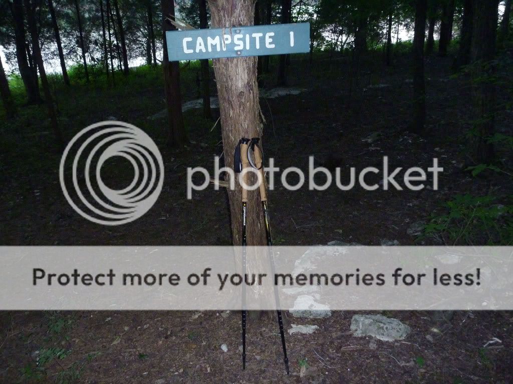
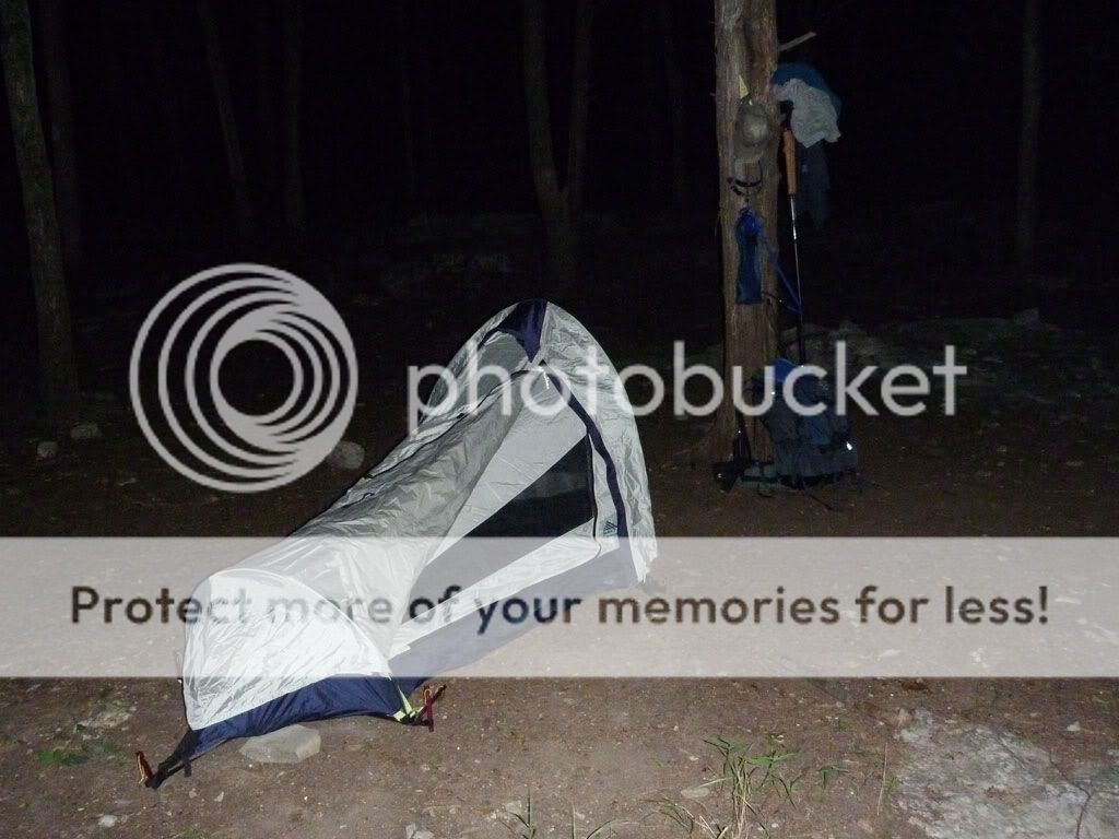


Camp was a pretty simple affair of a tent and a fire. Though I noted an abundance of downed limbs on my way in, the area around Campsite 1 did not hold very much firewood. Still, some kind soul had left behind a little kindling, and I was able to scrounge up enough limbs to have a good fire until I went to bed. To pass on the good karma, I left behind a couple of decent limbs I'd scavenged.
One point of interest was the numerous reflective specks that appeared each time my head-lamp beam hit the ground. There were hundreds of pairs, and upon investigation, I finally figured out that the specks belonged to tiny spiders (their eyes, I suppose). The size of the specks, however, did not coincide with spider size. I noted a pair near the fire at one point, and when I walked over to stoke the coals, I was surprised to find a specimen about the size of a silver dollar. Not quite tarantula-like, but getting there. As a point of order, I made sure my tent zipper was securely fastened once inside for the night.


Next morning, I woke up later than intended but still got out on the water to fish for a while. On the Long Hunter scouting trip, I'd noticed that the Corps of Engineers placed fishing structure directly in front of the Long Hunter campsite, so I took along some tackle. Though I'd eventually like to get a St. Croix travel rod (expensive!), Academy Sports had some very nice two-piece, ultralight, Quantum combos for only $30. And after some searching online, I found a very elegant solution for protecting the rod during transit—a plastic protective cover for a fluorescent bulb. In addition, I put together a small fishing kit in a Plano micro box, and I'm happy to report that each of the lures I selected caught fish. I was particularly impressed by the little Strike King crank bait and by the Kastmaster spoon.
After catching and releasing several small bass and one bold shellcracker, I had some breakfast, broke camp, covered the smoking coals in the firepit, and geared up for the hike back to the trailhead. The return trip went slightly slower than the day before, probably because I was traveling more in the heat of mid-day and because I made a long-ish stop to filter water.
Long Hunter Solo - Hike Out
One purpose of the trip was to assess gear in preparation for an upcoming backpacking trip at Big South Fork. To that end, this trip was a success, and below, I note some of the more important lessons learned:
- Two words: baby powder. The word chafe is never pleasant to contemplate on mile five of a six-mile hike. Discount stores offer powder in a trial size that is perfect for backpacking.
- Two more words: long pants. As mentioned, the trail got unruly in spots, and I suspected I'd see more ticks on the way out. Sure enough, after hiking through a particularly dense portion, I inspected my legs and found another Lone Star tick crawling around. On future trips along unfamiliar trails, I'll have long pants available. I even own some convertible hiking pants with zip-off legs, but I left them at home.
- Because of my tick encounters, I realized the value of a larger can of bug repellent with a higher percentage of Deet. I'm contemplating Permethrin but have not yet tried it.
- I've written about the usefulness of good boots and hiking poles with a child-carrier backpack. In similar fashion, with a weighty pack, these two items offer greater stability along the trail.
- Still, I am reconsidering footwear. I've long worn a pair of Lowa Scouts when hiking with my children on my back. But I've never done 11+ miles with the boots and substantial weight. By the end of day 2, I had some rubs and even a blister on one heel. I appreciated the ankle support the boots afforded, but I am tempted to try lighter weight hiking shoes on a subsequent trip.
- Speaking of weight, I did learn something about water's weight. My gear at the start came in at 43.5 pounds and fell to about 34.5 pounds once I got back to my vehicle. The difference, of course, was water. I began with 4 liters of water (8.82 pounds) and had no water by the time I got back to my truck. For the record, a liter of water is 2.205 pounds (1 kg).
- More on weight... As one might imagine, as the hike progressed, I began to reflect on extraneous pounds and ounces. I clearly had redundancy in some areas (e.g. three lights, two mugs). I carried in a sleeping bag that I did not even use (my silk bag liner was all I needed). I carried all my keys (instead of just my truck key) and my wallet (instead of just identification). I had more tent stakes than I really needed. While I'm not quite ready to start cutting edges off maps and removing labels from clothing, I do realize there are some simple ways I can cut weight from my pack.
- One item I was glad to have was my MSR MiniWorks EX filter. By the time I was ready to hike out Wednesday morning, I'd used up all four liters of water I took in. With the filter, I was able to make a quick liter from the lake, and about midway through my return, I stopped to make another liter. Without those two extra liters, dehydration would have been a sure thing, and without the filter, I would have needed to use purification tablets (which taste bad) or boiling (which takes time) .
- As for water portage, I used a 3L Camelbak reservoir for most of my water on the first day. However, I also had a wide-mouth Nalgene on my hip. The bottle was extra weight, but the Nalgene links up nicely with the MSR filter and makes the job of filtering much easier. It also serves as a measuring cup for prepping my freeze-dried food.
- I was happy to have along my Crocs. While an extra pair of shoes may seem like excess, Crocs are relatively light and comfortable. They were a blessing once I got to camp, and they were useful for wading.
The Numbers Miles Hiked: 11.4 Average Speed: 2.2 mph Pack Weight at Start: ~ 43.5 pounds Pack Weight at Finish: ~ 34.5 pounds Water Used: 6 liters Deer Spotted on Day 1: 6 (including two large bucks) Deer Spotted on Day 2: 1 (and a bunny rabbit) Skunks Smelled: 3 Ticks Found: 3 (1 in my knee) |
Friday, July 2, 2010
Long Hunter Scouting Trip
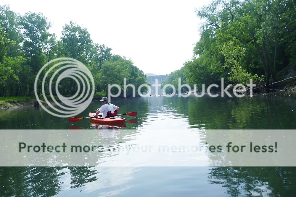
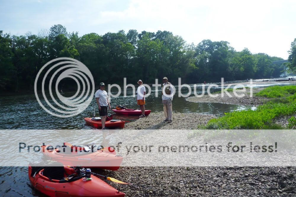
Early this morning, Jimmy and I launched out of Smith Springs Recreation Area and navigated Percy Priest Lake (a.k.a. Percy Priest Sea) in conjunction with Team Essence—middle Tennessee's premier militant sea-kayaking organization. Our roughly ten-mile paddle took us northeast up to Long Hunter State Park and then back again, the trip serving two purposes. First, I wanted to find out if the white bass bite resembled that of a year ago. Second, since Jimmy and I plan to hike overnight at Long Hunter in the next couple of weeks, we wanted to scout the primitive campsites at the park.
The bad news? No shad schools and white bass frenzies. But the good news was that the primitive sites offered shade, firewood, fire rings, and flat spots for pitching a tent. Judging by the state of the fire rings though, those campsites don't see a lot of traffic.
Click pictures to enlarge.


Below is a GPS capture of our track, which includes a few waypointed pictures from the campsites. On the return trip, we took a much less direct route and toured the campgrounds over at Seven Points Recreation Area. Overall, boat traffic on the lake was minimal, but it was already starting to pick up for the holiday weekend by the time we were taking out around 11 a.m.
Long Hunter Scouting Trip
In addition to photographing and waypointing the two campsites, I also grabbed some video captures. In the clips below, the picture quality is much better with 720p (HD) selected, but load time is longer.
Friday, June 18, 2010
Harpeth Woods Trail at Edwin Warner
Today, C and I broke our usual routine of hiking Radnor State Park and ventured a little further west to Edwin Warner Metro Park. C had already visited Warner Park Nature Center on a school field trip, so he had fun showing me around some of the exhibits before we hiked. We decided we could handle the 2.5 mile Harpeth Woods Trail, and even though we got a later start than expected, we had plenty of daylight left to finish. The trail itself was in great shape despite a landslide in one section due to the May flooding in this area.
Trip highlights included: following a pair of pileated woodpeckers down the trail for 50 yards or more, seeing the old rock quarry adjacent to the main trail, scraping a knee (unfortunately) atop the quarry, stalking two deer with "Indian feet" at the end of the hike, and spotting a rabbit beside the truck just as we were about to leave. Below are a few select pictures, a couple of links to all pictures from the hike, a link to the hiking map for Edwin Warner Park, and a GPS capture of our route.


Monday, June 14, 2010
Caney Fork Camp and Float
This past weekend, four of us trekked over to the Long Branch campground alongside the Caney Fork River, the plan being an all-day fish & float on Saturday and a shorter float on Sunday.  On Friday, I experienced the perils of speed packing at the last minute. With my inner Boy Scout shouting "You might need that!" at every turn, I threw way too much stuff into the truck, and of course, I forgot some of the essentials (think food here). Fortunately, the Lebanon Walmart Supercenter en route carried my favorite Mountain House freeze-dried pouches and a few other items I needed. After a stop for supplies and dinner, Mike, Robert, and I got to the campground with enough sun to spare and set up camp. The spot, campsite number one, was perfectly located. We were only about thirty yards from the boat launch, and a short walk down some steps gave us easy access to our put-in. The showers/restrooms conveniently sat right across from us, and the site featured a fair amount of shade during the day.
Later that night, I walked down to the boat ramp and cast a Rapala minnow blindly into the dark river. My head lamp didn't help because of the dense fog covering the water; visibility was probably three feet or less. Still, I managed to hook and land a nice 13.5" rainbow which turned out to be the biggest fish of the weekend.
DAY TWO - SATURDAY
The next morning, after we roused ourselves and had some breakfast, the three of us got kayaks rigged and ready, and then Robert and I headed out to drop my truck at the take-out. Mike kept an eye on camp. At the same time, Jimmy was driving over to Long Branch, and everyone was to congregate at the campsite by 10 and hit the water by 10:30 or so.
Click pictures to enlarge.


Robert and I passed up Betty's Island as a take-out and went in search of the Kirby Road pull-off marked on the Corp of Engineers map. On the way, we discovered that the bridge on Betty's Bend Road had been restored; just a year earlier, that bridge had been out. And despite a local telling me that Kirby Road was hard to find, it was in fact nicely marked with a street sign. The road was a one-lane affair and off the beaten path, but we eventually found a busy parking area just beneath the I-40 overpass where take-out wasn't going to be too difficult. We headed back to camp, taking the shorter route along Betty's Bend Road, and Jimmy timed his rendezvous nicely. After a bit of finagling and final rigging, we launched into the Fork.
Along with 100 other people.
Well, maybe it wasn't that crowded, but it was crowded. "Disney on the Fork" is what I kept calling it. I felt sorry for the poor fly fishermen whenever a group of canoes or kayaks plowed right through their casting area, and I tried to be respectful with my boat's line. But with the throngs drifting together in one big polymer and aluminum armada, my efforts really didn't matter. 


One group of local color raised a continual ruckus in their canoes, and the snatches of conversation we gleaned were priceless. One memorable, cryptic line was: "Walmart ain't like Las Vegas." Now I sense that the utterance contains infinite wisdom, but I admit I'm still trying to decipher it. My first inclination was that it involves the People of Walmart website, but after more reflection, I'm convinced the line has deeper philosophical significance. Further downriver, another fellow was apparently practicing his standup act and shouting Little Jimmy Dickens jokes to two victims of proximity in a nearby canoe. Peaceful it wasn't, but the entertainment value was high.
At the Happy Hollow area around mile five where most folks were taking out, we noticed a storm brewing behind us, and we made a dash downriver to see how far we could get before it hit. It didn't take long. Mike and Jimmy sought refuge under some tree canopy and enjoyed a brief shower. Robert and I, on the other hand, benefited from lingering back a ways and found cover under the I-40 bridge just as the bottom dropped out. The deluge was short lived, and once we got under way again, we enjoyed a quieter, less populated river.


The last half of the float offered up an eerie, picturesque river often covered in fog. We had plenty of fantastic scenery. But what we didn't have was current. Launching after 10 in the morning, we had counted on the Center Hill Dam generation, which purportedly ran from 2 p.m. until 5 p.m. However, we didn't note any significant rise in the river until 6.5 hours into the trip as we stood on Betty's Island around mile 8. As a result, we were on the water longer than we thought we would be. Total trip time on Saturday was just over 7.5 hours, and we covered around 10.5 miles. The trip route can be seen in the GPS capture below.
Caney Fork - Day Two
Overall, we didn't have much luck fishing. I caught a couple of trout near the boat launch Friday night and Saturday morning. And in the upper stretch of our float, I added 6 more small trout (including 2 browns), 2 bream, and a tiny bass. In addition, I know Jimmy and Robert both caught fish, but the numbers and the sizes weren't great. The lower portion of our float past Happy Hollow looked superb in terms of cover, structure, water clarity, and water depth. I fished parts of it hard but struck out. Nada. Not one single fish in the last four miles. Just as we were about to take out, we passed a couple of guys tossing gigantic (10" to 12") plugs, and I confirmed that they were fishing for the big browns. But we didn't see them hook up either.
That night, back at camp, some of us enjoyed three-hour hot dogs. (Note to self: never again attempt to light charcoal briquets for food prep with a fire starter brick.) And we sat around and shot the breeze until everyone was exhausted enough to crash in the hot, humid weather. (Note to self: the box fan is always a smart move in the summer where electrical hook-ups are present. Score one for the inner Boy Scout.)
DAY THREE - SUNDAY
Next day, we arose, ate, tidied the camp, and then ran my truck down to the Happy Hollow take-out for a shorter five-mile-ish float. Once on the water, we again encountered pretty high traffic, and I was surprised we didn't witness someone hooked by a fly cast, either on purpose or accidentally. We almost did see some fisticuffs between two fellow canoeists, and in a few spots, we encountered more fog floating lazily over the water.


One fun part of the Sunday float involved taking the channels behind three islands in that stretch of river. Jimmy, Robert, and I ventured into the first one and contorted our way under a fallen tree only to find we needed to portage about ten feet to get across a shallow run of water. The next two channels, though shallow in places, were clear their entire lengths. Mike, Jimmy, and I explored the second one, and then Jimmy and I paddled the last one. These creek-like waterways reminded me of the run we paddled next to our camp island on last year's Etowah trip. Below are some pictures of the channels along with a GPS capture of my route.


Caney Fork - Day Three