I Paddled the Length of Percy Priest.
What Have You Done?
I stole the alternate post title from Jimmy, who claims we're having t-shirts made up with the statement/question on front and back. The paddle itself was a long time coming since we planned the excursion way back in July of last year. We even went so far as to make two scouting runs (see Early Morning Priest Paddle and Percy Priest Scouting Trip).
With a window of nice weather and some weekday time during spring break, we finally decided that all systems were go. On Monday, we dropped off Jimmy's vehicle at the Percy Priest Visitor's Center next to the dam, and V drove us down to the Mona launch on the East Fork of the Stones River. Jimmy and I had both done dry runs with all our gear, so we were loaded up and ready to go in pretty short order. We launched at 1:30 and had in front of us a roughly 12-mile paddle and a 5:48 sunset.
Percy Priest Overnight Trip
DAY ONE
Even though we launched in the river, we were still paddling flat water since Percy Priest Lake backs up well into the Stones. Navigating the channel offered scenic views of long rocky bluffs and encounters with a lot of fishermen. Aside from the one crazy silver-haired man who kept ripping past us, apparently in a quest to speed-fish the Stones, the fishermen were friendly and curious about our destination. One of my favorite parts of the trip involved their incredulous looks and surprised comments when we mentioned we were headed to the dam.
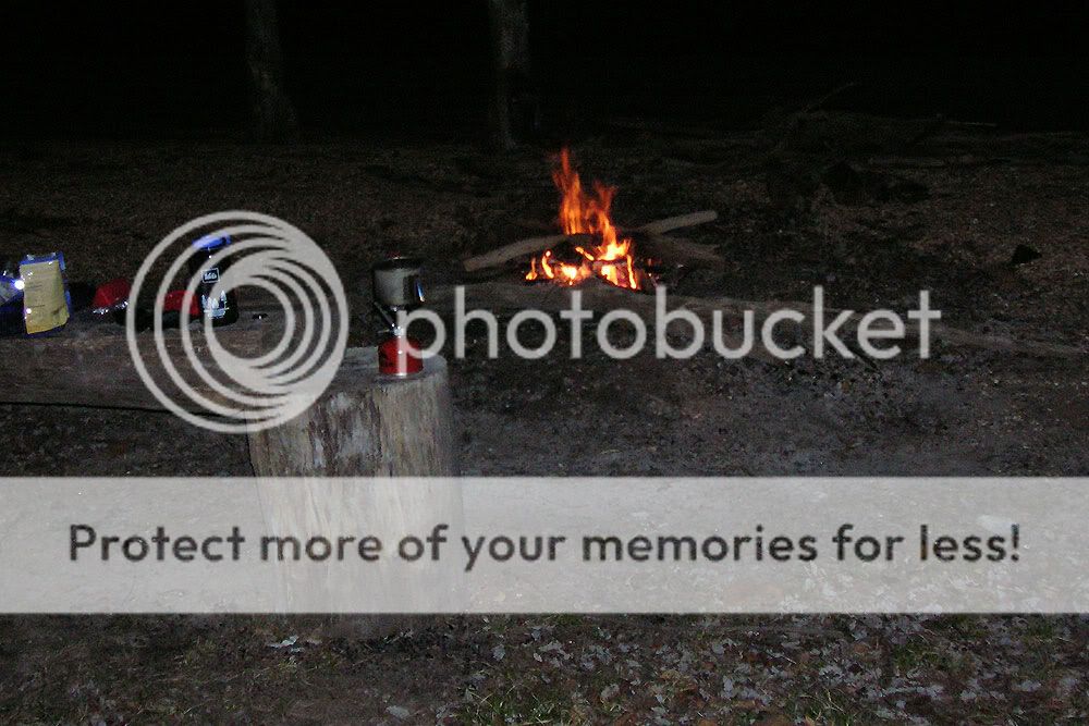
Jimmy pushed the pace on day one, and it was a good thing he did. When we got to an area he calls "Dobbins Pass" (there was an unpleasant incident with a ski boat and shallow water...'nuff said), we found winter pool to be so low that we would have to portage to stay on our intended route. Determined to paddle the entire way, we instead detoured north over the tip of the adjacent island—an addition that tacked on about 2.5 miles to our daily trip. As a result, we got to our campsite on River's Bend Island later than planned. We had just enough twilight to haul out the kayaks and pitch tents, and we wound up gathering wood in the dark. Thank goodness for head lamps.
Click pictures to enlarge.


CAMP
Camp was a pretty simple affair—a couple of small tents, a couple of tripod stools, and a fire. Probably because it was off-season for campers, we found plenty of long lengths of drift wood right around our campsite and managed a better fire than I'd hoped. For dinner, we both went the Mountain House freeze-dried route, and we sat around the fire and talked till about 10. I slept better that night knowing that the longer portion of the trip was behind us.

Up before dawn the next morning, I stoked the camp fire coals, added some remaining wood to the firepit, and got water boiling for coffee. Just across the lake, two turkeys woke up with the sun and started gobbling back and forth for a good 15 minutes or more. I had fun listening to their conversation while I prepared my freeze-dried omelette in a bag. After some breakfast and a quick breakdown of camp, we buried the remaining coals and hit the water around 7:30 for our 10-mile leg.


DAY TWO
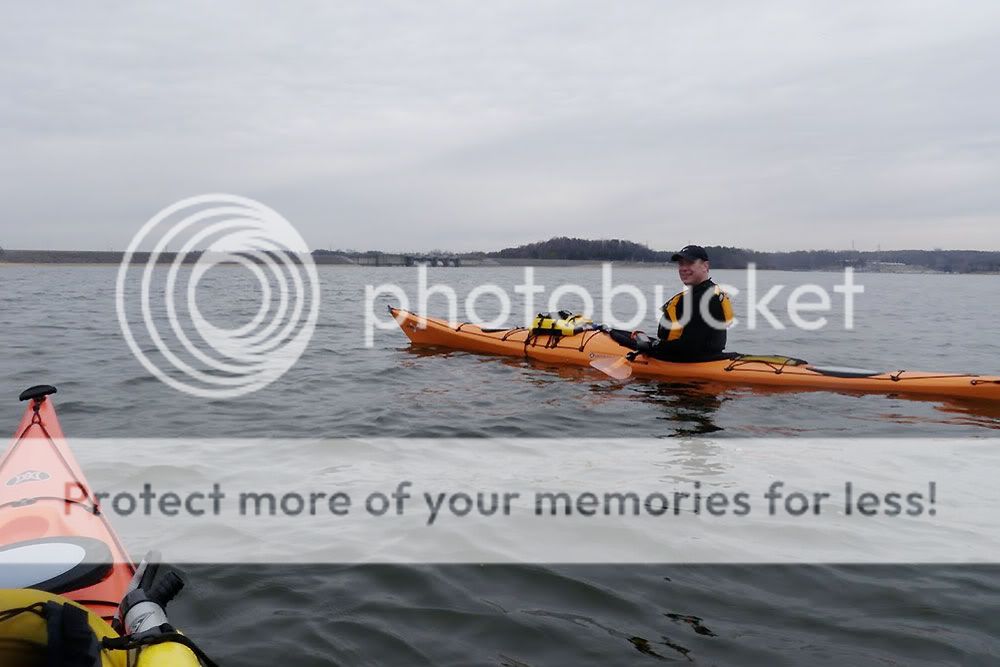
I set the pace on day two, feeling much better than I had the day before. Maybe it was the Advil Jimmy brought. Maybe it was the fact we only had ten more miles. For Jimmy though, I think attitude was just the opposite. His kayak, we found, suffered from a curved plastic skeg, and the entire trip, he had to paddle harder on the right to stay straight. After fifteen miles, he was already aggravated; the last ten just put salt in the wound. Clearly though, he earned the Determined Paddler Award and the nickname "One-Gun Jimmy," at least until his kayak is fixed.
We stopped a couple of times, once so Jimmy could filter some drinking water and again at the 171 bridge to grab a snack and filter more water. Nevertheless, we made good time, getting to the dam from our campsite in about three hours. We were able to see the dam just past the Anderson Recreation Area, and even though it was still three miles away, it added some incentive for the final push.
Regarding boat speeds, here are the totals: On day one, we paddled 14.5 miles in right at 5 hours (~2.9 mph). On day two, we paddled 10.5 miles in just under 3 hours (~3.5 mph). The latter speed is more indicative of what we've done with unloaded kayaks. Those numbers, of course, reflect stopped time as well. When moving, the Essences easily cruise between 4 and 5 mph.


GEAR NOTES
Below are a few observations about new gear and/or lessons about old gear...
- Because of the cold water temperature, I purchased an NRS Farmer John wetsuit for this trip. It did a great job on day one of keeping me warm, and the sleeveless design gave me plenty of room for shoulder rotation. Even though I didn't have the gumption to put on the cold, wet garment on day two, I think it will be a useful piece of gear for paddles in late fall, winter, and early spring.
- I also picked up two three-packs of Outdoor Products dry sacks. My larger dry bags work well for items like my tent, sleeping roll, and sleeping bag. The smaller dry sacks, however, make it much easier to organize, stow, and protect little items. My Perception Essence has a relatively small cargo hold just behind the cockpit, and these dry sacks fit into its portal without any fuss.
- I learned an important lesson about my Garmin 60CSx handheld GPS. To compress data when saving a track, it strips away time information. So when I saved our track for day one and then cleared my active track log on day two, I lost all the time info for day one. I should have simply reset the mile counter on day two. Lesson learned. Fortunately, Jimmy's Garmin did retain the info.