This past Wednesday, I joined Jimmy for a quick loop around the Long Hunter State Park mountain bike trail, a.k.a. the Jones Mill trail. The track was in great shape, though I couldn't really say the same for myself. Still recovering from head and chest colds, I had the wind of a three-pack-a-day Marlboro Red smoker. Nonetheless, I enjoyed getting out on a great day.
Forgot the Garmin, so I tracked with my iPhone, which didn't do too badly. Below, I show the iPhone track (3.3 miles) followed by an overlay with a Garmin track (3.4 miles) taken on a previous trip. They're not spot on, but they're close enough for government work.
Long Hunter
Map created by EveryTrail: Travel Community
Long Hunter - Combined 2
Map created by EveryTrail: Travel Community

Friday, November 27, 2009
Long Hunter Loop
Sunday, November 15, 2009
Mechanic's Day Out at Lock 4
Mountain biking at Lock 4 this morning was a matter of starts and stops. When I met Jimmy around 9:30 for a loop around the course, the weather was perfect, and our ride began well enough. But about halfway through BLT 1, Jimmy's single speed lost its chain, and we paused for a few minutes to get it back on the cogs.
Then, not even a half-mile later, we were headed into BLT 2 when I heard "Aaaargh! I'm down again!" I proceeded up the trail a ways, but then one of our prime directives (Leave no man behind!) kicked in, and I pulled over to wait. A couple of minutes later, however, another rider pedaled by me and reported that someone had broken a chain. I rode back to the entrance to BLT 2, and sure enough... chain down.
Lock 4 First Attempt
Map created by EveryTrail: Travel Community
We fiddled around for a while and figured out that (a) my extra link was the wrong size and (b) Jimmy was going home unless we could locate a single-speed replacement link. As I pedaled back to the parking lot to check, Jimmy began the slow walk of shame—a walk to which I am no stranger. At first, I didn't think we were going to have any luck finding extra chain, but finally, we located a single speeder with a few links. After considerably more finagling, we were back in business.
On our second attempt, however, I wound up with a lot of starts and stops myself. My Marin began emitting a sporadic popping noise, and despite all my attempts to isolate the source, I was never able to figure out exactly where the sounds originated. I got so obsessed with my investigative work that I crashed off-trail at one point. No substantial injuries to report. Just frustrations. However, if this link is any indicator, a crank or pedal is the likely culprit.
Lock 4 Second Attempt
Map created by EveryTrail: Travel Community
Because of the repair time and because of my own frequent diagnostic delays, I had to bug out before completing a full loop. Considering my short-winded physical condition, however, an early retirement was somewhat welcome. One lesson from today: I definitely need to get out and ride more. All told, I covered about 5.5 miles according to the Garmin, but I was not riding with any speed or energy.
Side note: I've often wondered if turkeys live over in the Lock 4 area. We see a lot of deer, but until today, no turkeys. On the way home, I spied and photographed a big flock (30 birds or more) in a front yard near the park. My guess is that the birds reside in the woods close to Lock 4 but that the frequent bicycle traffic keeps them away from the trails.


Sunday, November 1, 2009
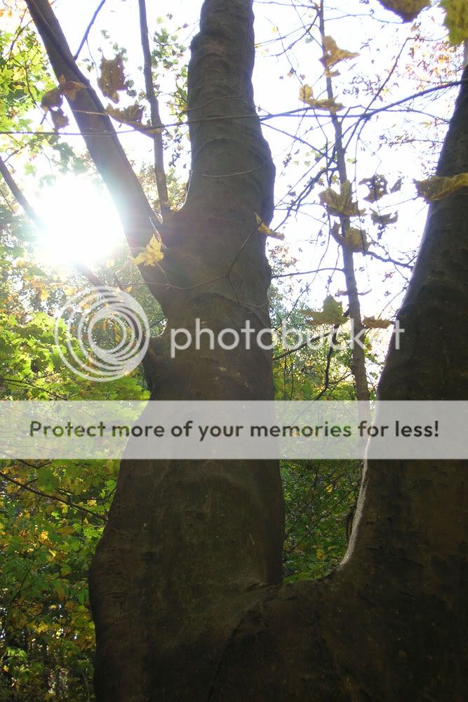
Fall Day At Radnor
The morning was so pretty that we mobilized children and gear and made for Radnor Lake. A few weeks back, C and I hiked the South Cove Trail, and I thought today's timing would be right on track for a resplendent display of fall leaves. Because of the many recent rainstorms, however, a lot of the leaves were on the ground. Even so, the park was still gorgeous with its mixes of greens, oranges, reds, and yellows.

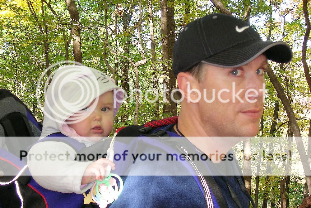


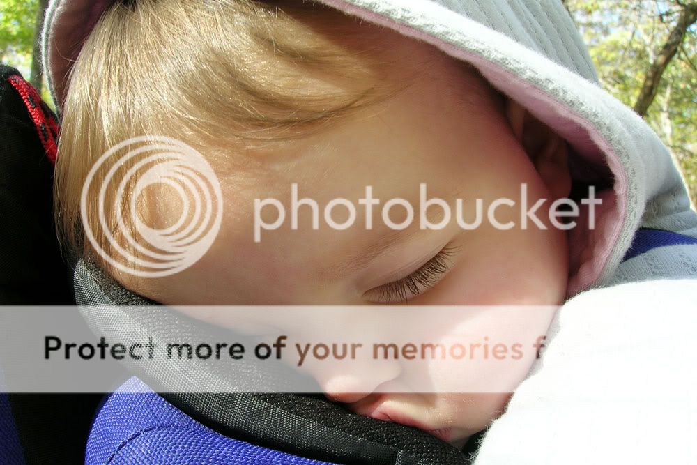
We hiked the Ganier Ridge Trail and then made a small jaunt down the lakeside road to take some pictures. All told, we covered 2.8 miles according to my Garmin, which captured the track below. C was our trailblazer and led the entire hike. E cooed and sang most of the way before finally conking out. As luck would have it, we ran into my friend Kevin, walking with his parents by the lake, and he took a rare shot of the entire family.
Hike at Radnor at EveryTrail
Map created by EveryTrail: Share and Plan your Trips