Sunday, December 27, 2009

Long Hunter Day Loop


This afternoon, C and I loaded up gear and headed to Long Hunter State Park, home to one of my favorite trails in the area, the four-mile Day Loop Trail. A portion of the Day Loop coincides with the longer Volunteer Trail, and as the park website notes, "These trails wind along the shore of J. Percy Priest Lake, climb overlook bluffs, and wander through hardwood forest, cedar glades, and interesting rock outcroppings." Both offer great scenic hiking, no matter the time of year.

Click pictures to enlarge.
Photobucket Photobucket

C got to try out his new hiking pole, compliments of Santa Claus, and since the temp was only in the mid-40s, we remembered the hot cocoa—our favorite cold-weather, hiking companion. Right around the two-mile mark, we took a break on one of the rocky bluffs, snacked on trail mix, and slurped down our hot chocolatey treat. At the end of our hike, as we headed up the gravely path that empties into the parking lot, we saw a deer standing almost at the trailhead. It watched us for a long time before deciding to bolt, and another deer jumped the trail right behind it.

Photobucket Photobucket

Long Hunter Day Loop


⇒ Click here for a more detailed .pdf map of Long Hunter State Park.

Photobucket

Tuesday, December 22, 2009

Late Run at South Cove

C and I got a late start hiking at Radnor Park today, but we decided to try the South Cove Trail anyway. An approximately 2.7 mile jaunt, the South Cove sits opposite the lake across Otter Creek Road. It's a pretty hike with a number of climbs that take you up to a nice ridge line before descending rapidly back down to the road.

Late Run at South Cove

Map created by EveryTrail: Travel Community

Today, we had a guest hiker along. A new stuffed animal, Sharpy the lizard, rode in C's pack most of the way. Sharpy picked a good day to come out. The weather was absolutely gorgeous for December, with temps up into the mid-50s.

About half-way through the hike, we saw a herd of nine does browsing along for acorns, and C correctly identified a bright red cardinal just off the trail as a "boy bird." We cut it pretty close, getting back to the truck as nightfall came, but I think C enjoyed getting to use his flashlights for the last half mile or so.

Click pictures to enlarge.
Photobucket Photobucket

Monday, December 21, 2009

Trail Mix on the Cheap

The Loveless Cafe gift shop is not the place to shop for trail mix. Still, as a visitor there, I willingly forked over $5 for a Lilliputian bag of mix just the other night. Circumstances were such that, had I not shelled out the cash, my five-year-old was going to erupt into hunger meltdown. If you're a parent, you know it was money well spent.

I will say, however, that the mix was a good one. It consisted of dried raspberries, raisins, white chocolate chips, pecans, cashews, and almonds. It was a nice blend of sweet and salty/savory. After munching on some of the mix with C, I decided I needed to experiment with my own recipes.

Just so happens that we hit Dollar Tree today. In case you've been out of the country for a decade or were lucky enough to enter the world with a silver spoon dangling from your lips, the Dollar Tree is a retail outlet where every item is a dollar or less. Being an ever-alert shopper, I quickly discovered that the store offered trail mix supplies aplenty, and for $7 plus tax, I picked up the following:

      • 2 bags of salted cashews
      • 1 jar of peanuts
      • 1 bag of banana chips
      • 1 bag of sunflower seeds
      • 1 bag of yogurt covered raisins
      • 1 bag of Tropical trail mix (with pineapple, raisins, dates, bananas, papaya, coconut)
Since Kroger was just next door, I ducked in for a few more items. These additional ingredients were decidedly pricier, but I felt like they really added some nice flavors to the mix.
      • Sliced almonds @ $1.80 a bag
      • White chocolate chips @ $2.50 a bag
      • Ocean Spray dried cranberries (both regular and cherry flavored) @ $2.50 a bag
At home, I mixed everything up in a giant bowl, tossing in a few more raisins from our supplies, and voilà! A tasty result if I do say so myself. The whole concoction came in under $18 with tax and made up enough mix to stuff a gallon-sized Ziploc. At the Loveless, we would have needed to sell our second child to afford that much trail mix. The lesson here? If you need a nice, healthy snack on your next hike, the dollar store is definitely your friend.

Photobucket

Friday, November 27, 2009

Long Hunter Loop

This past Wednesday, I joined Jimmy for a quick loop around the Long Hunter State Park mountain bike trail, a.k.a. the Jones Mill trail. The track was in great shape, though I couldn't really say the same for myself. Still recovering from head and chest colds, I had the wind of a three-pack-a-day Marlboro Red smoker. Nonetheless, I enjoyed getting out on a great day.

Forgot the Garmin, so I tracked with my iPhone, which didn't do too badly. Below, I show the iPhone track (3.3 miles) followed by an overlay with a Garmin track (3.4 miles) taken on a previous trip. They're not spot on, but they're close enough for government work.

Long Hunter

Map created by EveryTrail: Travel Community

Long Hunter - Combined 2

Map created by EveryTrail: Travel Community

Sunday, November 15, 2009

Mechanic's Day Out at Lock 4

Mountain biking at Lock 4 this morning was a matter of starts and stops. When I met Jimmy around 9:30 for a loop around the course, the weather was perfect, and our ride began well enough. But about halfway through BLT 1, Jimmy's single speed lost its chain, and we paused for a few minutes to get it back on the cogs.

Then, not even a half-mile later, we were headed into BLT 2 when I heard "Aaaargh! I'm down again!" I proceeded up the trail a ways, but then one of our prime directives (Leave no man behind!) kicked in, and I pulled over to wait. A couple of minutes later, however, another rider pedaled by me and reported that someone had broken a chain. I rode back to the entrance to BLT 2, and sure enough... chain down.

Lock 4 First Attempt

Map created by EveryTrail: Travel Community

We fiddled around for a while and figured out that (a) my extra link was the wrong size and (b) Jimmy was going home unless we could locate a single-speed replacement link. As I pedaled back to the parking lot to check, Jimmy began the slow walk of shame—a walk to which I am no stranger. At first, I didn't think we were going to have any luck finding extra chain, but finally, we located a single speeder with a few links. After considerably more finagling, we were back in business.

On our second attempt, however, I wound up with a lot of starts and stops myself. My Marin began emitting a sporadic popping noise, and despite all my attempts to isolate the source, I was never able to figure out exactly where the sounds originated. I got so obsessed with my investigative work that I crashed off-trail at one point. No substantial injuries to report. Just frustrations. However, if this link is any indicator, a crank or pedal is the likely culprit.

Lock 4 Second Attempt

Map created by EveryTrail: Travel Community

Because of the repair time and because of my own frequent diagnostic delays, I had to bug out before completing a full loop. Considering my short-winded physical condition, however, an early retirement was somewhat welcome. One lesson from today: I definitely need to get out and ride more. All told, I covered about 5.5 miles according to the Garmin, but I was not riding with any speed or energy.

Side note: I've often wondered if turkeys live over in the Lock 4 area. We see a lot of deer, but until today, no turkeys. On the way home, I spied and photographed a big flock (30 birds or more) in a front yard near the park. My guess is that the birds reside in the woods close to Lock 4 but that the frequent bicycle traffic keeps them away from the trails.

Photobucket Photobucket

Sunday, November 1, 2009

Fall Day At Radnor


The morning was so pretty that we mobilized children and gear and made for Radnor Lake. A few weeks back, C and I hiked the South Cove Trail, and I thought today's timing would be right on track for a resplendent display of fall leaves. Because of the many recent rainstorms, however, a lot of the leaves were on the ground. Even so, the park was still gorgeous with its mixes of greens, oranges, reds, and yellows.

Photobucket Photobucket

We hiked the Ganier Ridge Trail and then made a small jaunt down the lakeside road to take some pictures. All told, we covered 2.8 miles according to my Garmin, which captured the track below. C was our trailblazer and led the entire hike. E cooed and sang most of the way before finally conking out. As luck would have it, we ran into my friend Kevin, walking with his parents by the lake, and he took a rare shot of the entire family.

Hike at Radnor at EveryTrail

Map created by EveryTrail: Share and Plan your Trips

Photobucket Photobucket Photobucket
Photobucket

Thursday, October 22, 2009

Motobecane Fantom 29Pro SL Arrival


My new 29'er mountain bike, a Fantom 29Pro SL from BikesDirect, arrived last night. I was excited it shipped so quickly, but when I first saw the box, I was far from happy. UPS had managed to gouge four large holes in one side. However, after opening the package, I couldn't find any damage to the bike. All seems well so far.

Photobucket Photobucket

Below is a stock photo of the complete bike. I'm going to change out the grips and the pedals, add some rim strips, and perhaps install a longer seat post. At some point, I may also put on tires with a more aggressive tread. After assembly and some trail time, I'll post up a review here.

Photobucket
Click picture to enlarge.

Sunday, October 18, 2009

Paradise Reopens


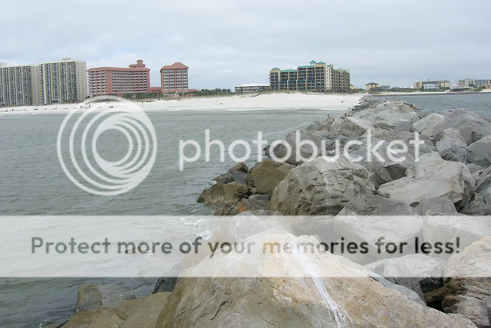
Fort Pickens Park, part of the Gulf Islands National Seashore, was closed for five years after Hurricanes Ivan (2004) and Dennis (2005) battered its home—the slender, peninsula-like Santa Rosa Island that protects Pensacola Bay. Finally, in May of this year, the rebuilt road to Fort Pickens was opened for public traffic. For fishermen, birders, campers, and history buffs, this reopening was welcome news.

Photobucket
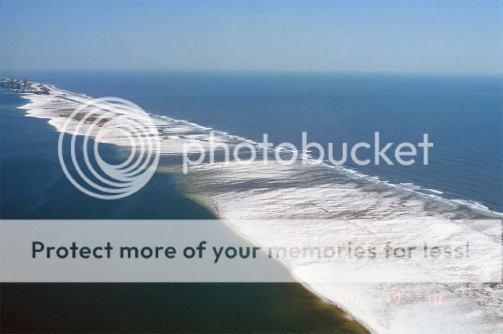
Santa Rosa Island after Hurricane Ivan @ http://coastal.er.usgs.gov/hurricanes/ivan/photos/florida.html


Back when I lived in Mobile, trips over to Pickens were fairly regular events, mainly because of the excellent fishing. With the island being so narrow, it is easy to fish both the bay side as well as the Gulf side, but the biggest draw for fishermen involves the pompano runs that occur along the beaches, particularly in early spring. Pompano, gamefish in the jack family, are usually caught on sandfleas and are valued for their robust fight as well as for their tastiness.

Yesterday, my friend David drove over to Orange Beach, picked me up, and hauled me over to Fort Pickens for some fishing. David's the Mobile native who first introduced me to inshore saltwater fishing and took me around to places like the Perdido jetties, Dauphin Island, and Santa Rosa Island.

Photobucket Photobucket

Temperatures were only in the mid-50s, but we decided to make a go of it anyway. We rolled east to Pensacola, made our usual stop at Gulf Breeze Bait and Tackle, and despite the fact that no sand fleas were available, we forged on with a couple dozen live shrimp and two frozen mullet.

However, when we stepped out of the car at the first beach access in Fort Pickens Park, I had my first "maybe this isn't such a good idea" moment. A cold wind was howling out of the north—picking up sand which felt like tiny needles on my skin and which immediately gummed up the worm drives on my two baitcasters. Just like that, not even out of the parking lot and without running water to flush the sand, I was down to one rod and reel.

Still, we fished. David was able to scrounge up some sandfleas with his fancy rake, but after a couple of hours with no bites, we decided to pick up and move. Before we left though, I grabbed a couple of .mov files on my digital camera. With the sound turned up, these two clips should give a pretty good sense of just how hard the wind was blowing. I feel compelled to note that we did see other fishermen that day, so we weren't the only nuts out there.


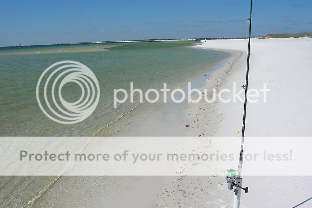
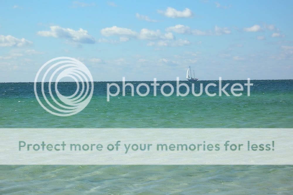
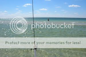
We relocated down the island to a place where we've fished a lot in the past. There, near the ranger tower, the dunes and part of the Pickens battery provided a much welcome wind break, and at this new spot, we found that the crystal clear water ran out thirty yards or more without getting over waist-deep. The water, unlike the wind, was surprisingly warm, so we stayed out in the shallows for most of the rest of the trip.

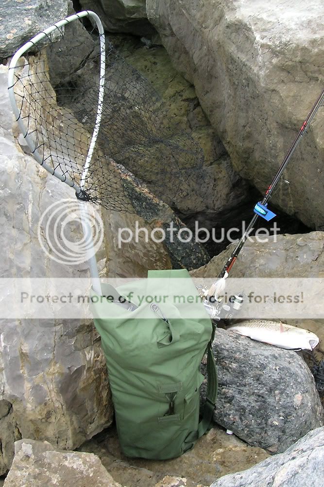
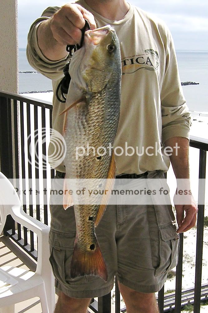
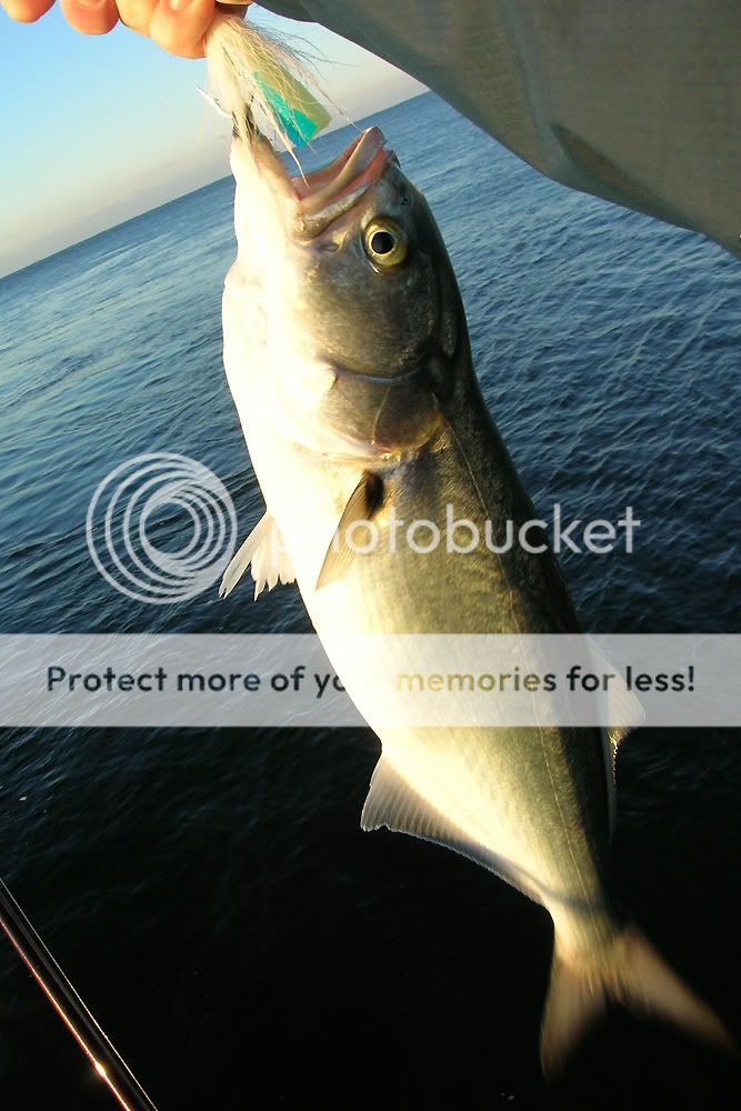
David finally managed to hook into a nice skipjack (ladyfish) that, for the longest, we thought was a pompano. It ran sideways like a pompano and did not jump like a typical skipjack. But it turned out to be the only fish of the day. We had lots of nibbles, and something kept taking our bait, but we never could figure out what was doing it. David guessed crabs. I have no idea.

Photobucket Photobucket

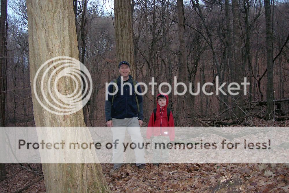
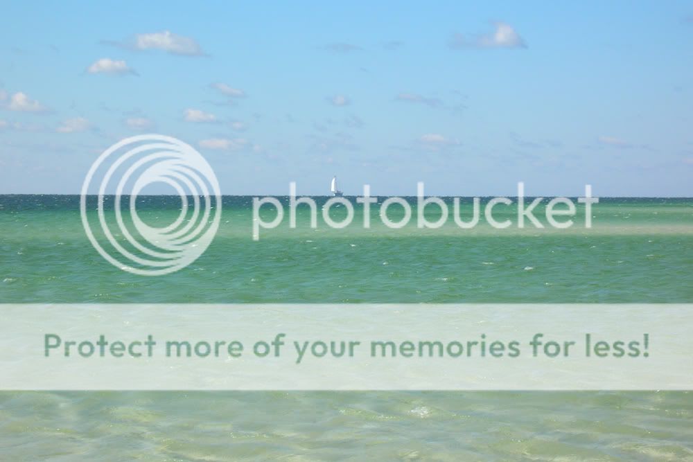
It didn't matter to me that I went 0'fer on the fishing. I had a great time catching up with David, and the park itself was reward enough. I mainly wanted to see beaches as beaches should be seen—free of condos and surf shops and restaurants. To gaze on the shore at Pickens is to step back in time and realize what early inhabitants or early explorers saw when they came upon a coastline. Truly, it is one of the more beautiful places I've visited, and I hope to take my son and daughter there one day to see its splendor. Maybe we'll even fish for pompano.

Friday, October 16, 2009

Another Pirate Turns 40

I spent the morning at one of my favorite fishing spots, the jetties at Orange Beach and Perdido Pass. Years ago, on the same rugged, barnacle encrusted rocks, I got my introduction to inshore saltwater fishing, and as long as I'm able to clamber back out there, it's a place where I'll occasionally return to restore my inner sense of rhythm. It's one of the settings where I feel most at ease.

Photobucket Photobucket

On these jetties, I've caught just about every inshore fish native to the area. Part of the appeal of the place is that I never know what I'm going to catch, but I almost always catch something. With an outgoing tide, predatory fish like to wait just outside the current spilling from the pass since the tide pushes food, be it shrimp or crabs or smaller fish. In terms of tactics, casting to the current line is ideal, and it's much easier to do when standing on the very last rock. However, the scramble out there with rods and tackle is no cakewalk, and lugging a bucket full of water and live shrimp makes the trip even more challenging.

Photobucket Photobucket

To transport all the gear, I use a backpack system copied from a fellow fisherman I encountered on the jetties several years back. It consists of a G.I. duffel with backpack straps, a five-gallon bucket with lid, and an aerated bait bucket. The lidded bucket holds the smaller bait bucket and prevents sloshes from soaking the backpack with smelly shrimp water. Tackle goes on top of the big bucket, and I slide a six-foot net down beside everything. Any other items (jacket, snacks, etc.) go in a stuff sack on top of the tackle box.

Once out on the jetties, the larger bucket provides a handy place to store catches. In the past, I've relinquished quite a few fish to the jetties because (a) they flopped off the rocks and back into the water, or (b) my stringer became stuck in a crevice in the submerged rocks. Between the long net for landing fish and the bucket for storing them, my catch and keep ratios have gone up.

Photobucket Photobucket

A new bait shop opened just across from where we typically stay in Orange Beach, so getting live shrimp was convenient for a change. The shrimp were surprisingly bigger than I'm used to and included a couple that were bordering on prawn-like.

Fishing was pretty slow on the whole, but I enjoyed being out there, listening to the crash of the waves on the rocks, and just slowing down. I did catch a few—including a pinfish, a catfish, a puffer fish, a couple of mangrove snapper, and a nice slot redfish. This last one, my birthday gift from the fishing gods, bit one of the really large shrimp and reminded me why I miss fishing down in the Gulf so much. I can't imagine many better ways to turn 40 than wetting a line in saltwater and having some success.

Photobucket Photobucket Photobucket

UPDATE: On the 19th and 20th, I returned to the point of the jetties with some artificial lures, including a hefty looking bait made up of a large bucktail jig dressed out with a blue/white Cocahoe minnow. (I must give props to José Wejebe of Spanish Fly fame for this idea.) Both days, I hooked into a few nice bluefish with this lure and managed to land a couple of them.

A gear note worth adding involves Teva sandals (pronounced TEV-ə rather than TĒ-və, by the way). They work as advertised. I have had a pair of Teva Terra Fi sandals for years now, and they are some of the best shoes I've owned for rock scrambling, especially around water. I have navigated the jetties barefooted before. Not recommended. The Tevas are the way to go. They grip well, stay secure on the foot, and dry out quickly when wet.