
Friday, July 31, 2009
Planned Percy Priest Perception Paddle
First, alliteration is cool.
Second, the past couple of sea kayak excursions have been preparatory trips for an upcoming paddle that will go the length of J. Percy Priest Lake. Team Essence was interested in (a) campsites around the halfway point and (b) the ease with which we could handle 10+ miles in the kayaks.
I've mentioned in a past post the efficiency that online mapping tools bring to trip planning. Instead of a topo map, this upcoming float was plotted quickly with bing™ maps (formerly Live Search maps), exported as a GPX file, and uploaded to Everytrail for inclusion in this post. I'll eventually mark my waypoints along the float and upload the two routes (Day 1 and Day 2) to my handheld Garmin just so we don't take any wrong turns out on the water.
Mona to Priest Dam - Day 1 at EveryTrail
Map created by EveryTrail: Travel Community
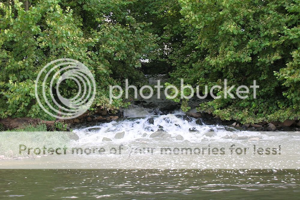
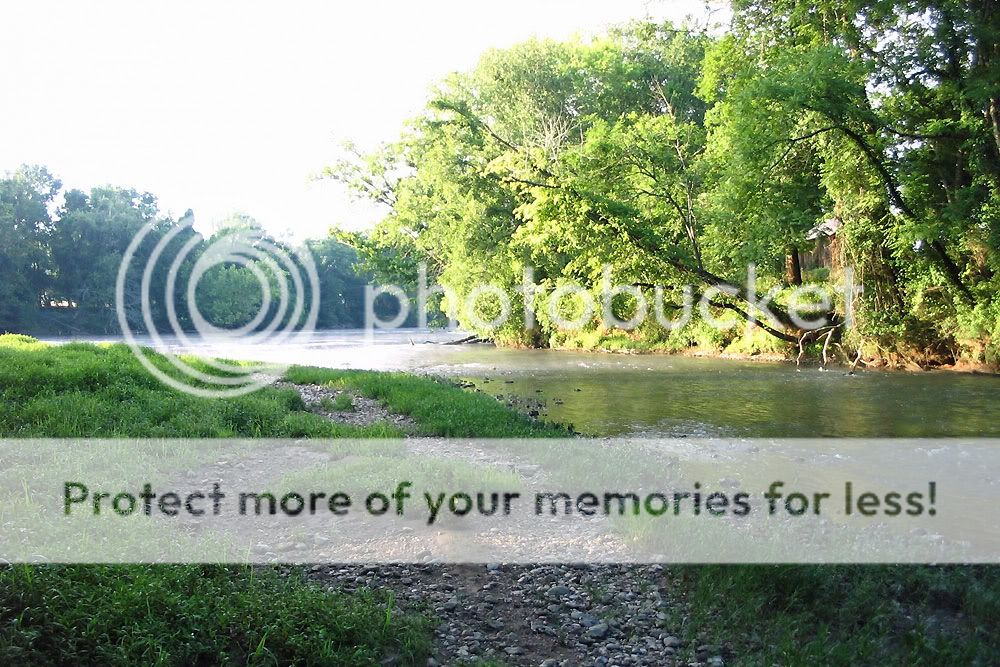
The first day will entail a put-in at the Mona boat ramp on the East Fork of the Stones River. We've paddled down there a couple of times before, including a float/drag of the East Fork that took out at Mona. From the launch, we'll paddle roughly 12.5 miles to one of the islands we scouted, pitch a couple of tents, eat some lovely dehydrated/rehydrated food, and maybe build and tend a small camp fire. The past couple of outings, we've paddled 8 to 9 miles easily in just over two hours, so the 12-mile leg should not be all that strenuous.
Next morning, we'll crank out another 10+ miles to the Hermitage Public Use Area just beside Percy Priest dam. In all, we will have paddled at least 23 miles, probably a little more, and covered Priest lake from its headwaters all the way to its end point. Should be fun.
Mona to Priest Dam - Day 2 at EveryTrail
Map created by EveryTrail: Geotagging Community
Percy Priest Scouting Trip
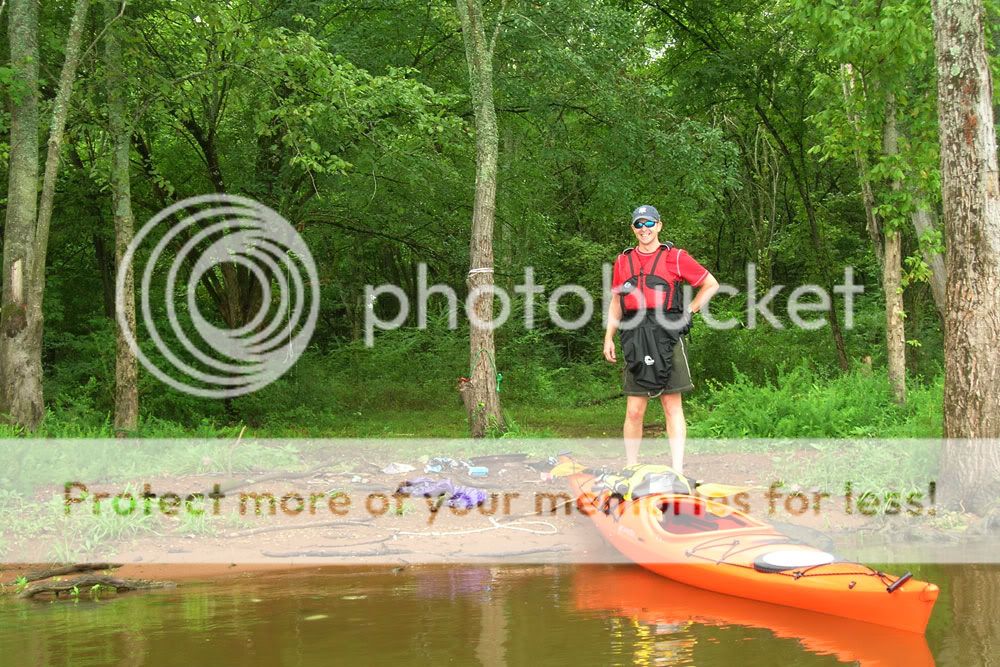
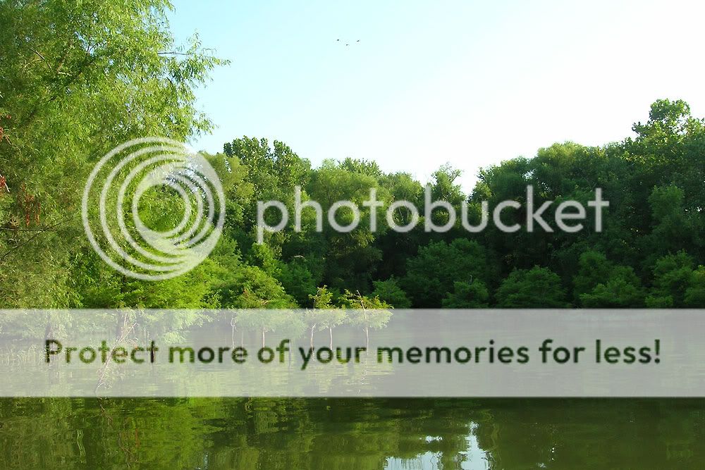
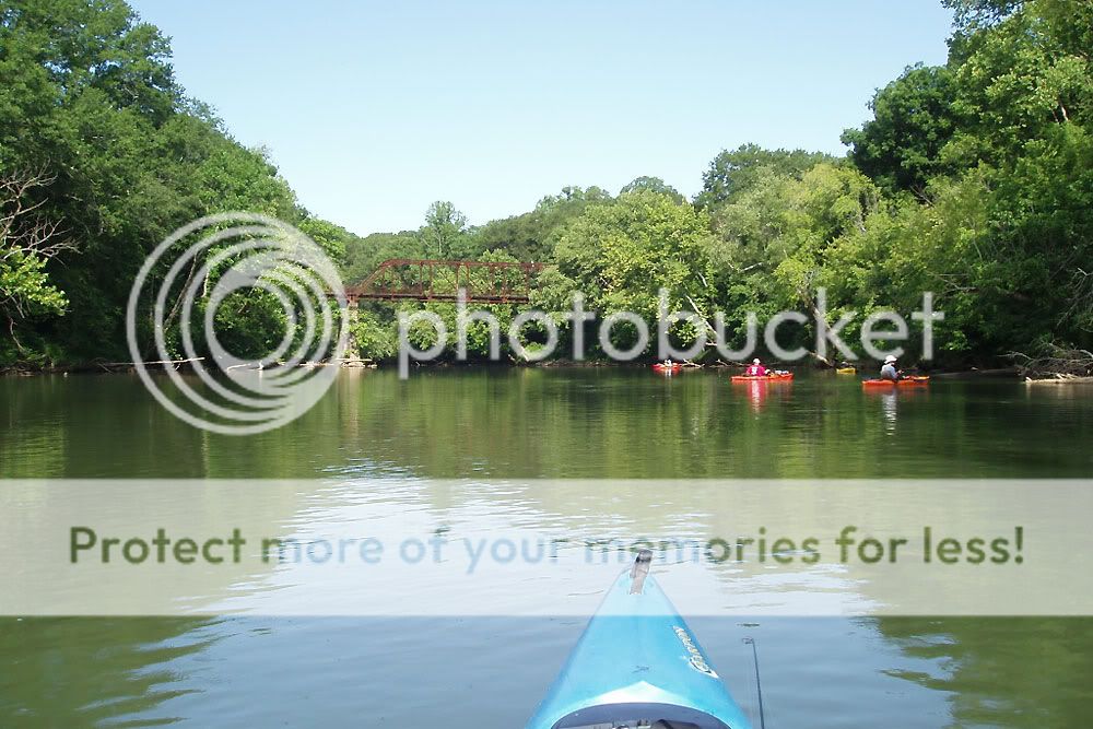
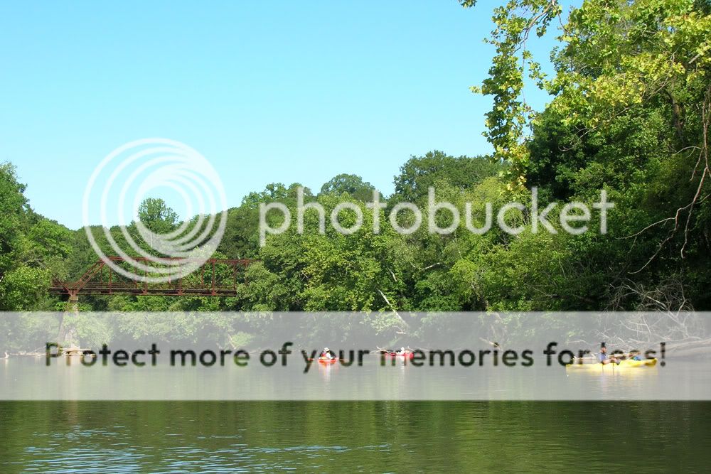
Team Essence launched around 6:30 a.m. for a scouting trip of the Rivers Bend and Poole Knobs islands on J. Percy Priest Lake. Putting in at the Long Hunter State Park boat ramp, we paddled southeast toward the islands under overcast skies. Because of storms that came through the previous night, paddling conditions were great. Cooler temps made for a pleasant round-trip right at 9 miles.
Beginning at the southern-most island (Poole Knobs), we searched out and documented the various campsites. We expected some trash since Jimmy had previously read this blog post about people leaving behind garbage on the islands. Well, we found it. The first site we visited looked like a dump with cans everywhere and litter scattered all back into the woods. When we return, we each should take a garbage bag to pack out some of the mess. The rest of the sites, however, weren't bad excepting one with a rusted-out grill turned over near water's edge.
Percy Priest Scouting Trip at EveryTrail
Map created by EveryTrail: Geotagging Community
With the Everytrail map above, you can zoom in (just double-click) near the two islands, click individual waypoints, and a picture of each campsite will pop up. Either island held good sites, and we noted one in particular on the southern point of Poole Knobs Island and several others on the eastern portion of Rivers Bend Island. I imagine we'll be stopping at one of these locations when we paddle the length of Percy Priest next month.
In terms of wildlife sightings, we angered a lot of fishing herons, and we encountered a rustic group with a giant Confederate flag about to spend the weekend on Rivers Bend Island. On a final note, visitors at one site had apparently implemented a strategy found at this link, judging by the camp amenity hanging from a nearby tree.


Monday, July 27, 2009
Early Morning Priest Paddle
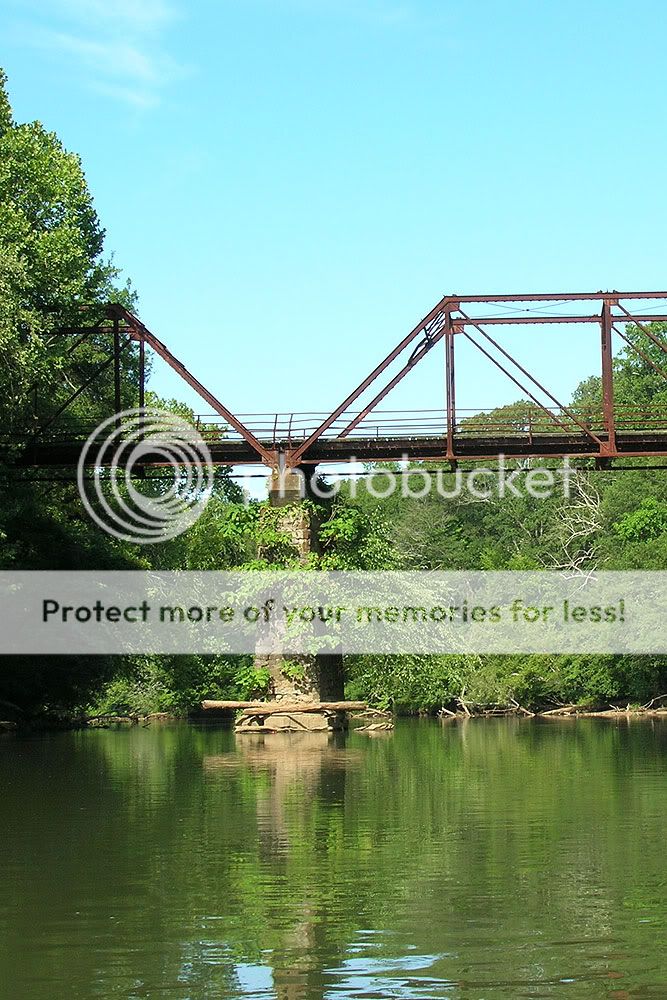
Team Essence hit J. Percy Priest Lake around 6:30 this morning and made a nearly 8-mile, mostly East-West loop that took us under Hobson Pike and around a couple of islands south of the bridge. In addition to getting some exercise, we also scouted a few campsites for an overnight trip planned from the East Fork of the Stones River up to Percy Priest.
Priest Paddle at EveryTrail
Map created by EveryTrail: GPS Community
The first island was marked as a "restoration area," and the local birds had made good use of the no-human rule, setting up shop on one end in particular. These water birds were markedly similar to the ones we saw back on Old Hickory in June. At least three species were present, including Great Blue Herons and two others that I presumed to be in the heron family.
The second island, dubbed Mousetail Island according to this Corps of Engineers map, held three campsites, all of which looked like good spots. Each offered easy access from a kayak, and one had a fair amount of downed wood for a campfire. When the weather cools, I hope we can get over that way for some primitive camping. A scouting trip to the other nearby islands (Ponderosa, Rivers Bend, and Poole Knobs) might be in order within the next couple of weeks.


Sunday, July 26, 2009
Family Hike at Radnor
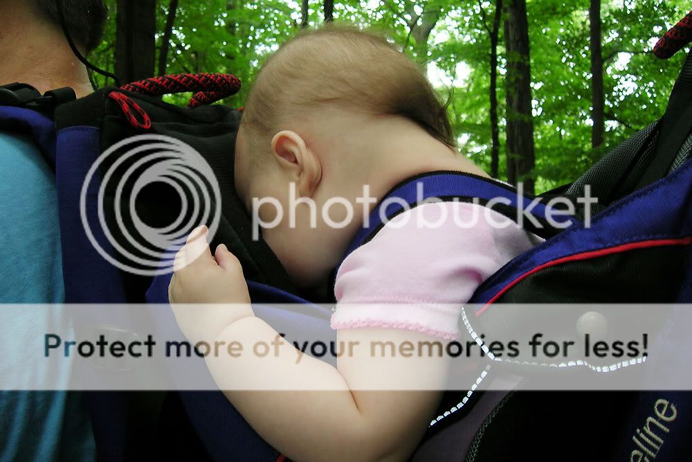
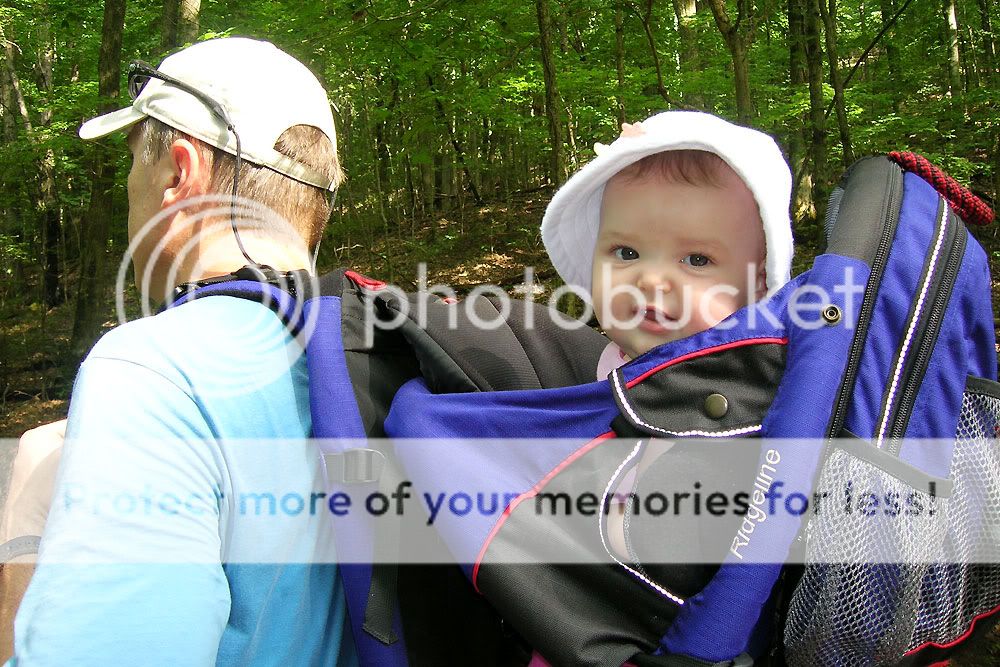
Well, we can hike again. As a family that is. We hiked with C when he was small, but then he hit that age range when he was too heavy to carry and too young to go any distance by himself. Now, however, he is all gung-ho about hiking, and as long as there's water (or hot chocolate in the winter) and snacks, he's in. Just recently, E has gotten to the point where her neck is strong enough to hold up in a child carrier. So we all hit the trail today.

Click here for a topographical trail map of Radnor State Park (3.7 MB).
We hiked close to 3 miles at Radnor State Park, a tranquil island of green in the middle of Davidson County. My favorite trail there is the Ganier Ridge which takes you up to a nice overlook in wintertime. In the summer, the canopy pretty much obscures any distant vistas, but it's still a nice walk in the woods. Though the Ridge Trail is only about 1.5 miles, it does have a climb and a descent that both get the blood pumping. All told, we hiked a short part of the Access Trail and nearly all of Ganier Ridge, and then we went south on the Lake Trail till we hit pavement. From there, it was just a short jaunt east to our parking spot.


The picture above displays how E negotiated most of the trail. Passed out asleep. C used to nod off in the child pack as well. Something to do with the rhythmical pace and the peace & quiet, I suppose. Today, E dozed through at least three-quarters of the hike, just waking up in time to grin for some pictures at the end. Below I've juxtaposed a picture of C snoozing in 2005 next to a pic of E zonked out on today's hike.

Our short excursion was a good one. We took a water and snack break up on the ridge; C hammed it up with his Swiss Army knife and a tree he "cleared" off the trail; and we saw a little spotted fawn with its mother up close. We all got some much needed exercise, and we enjoyed each other's company in the great outdoors. Not a bad way to spend an afternoon.


What follow here are a few of my thoughts about hiking with children:
- Keep it short and slow. A hike with children is not the occasion to post your personal best time for 10 miles. The point (I hope) is to enjoy the outdoor world with your children and teach them to appreciate its beauty. Every child is different, of course, but 2 to 3 miles is plenty of hike for our family right now.
- Some basics are a must: fluids, snacks, bug spray, and sunscreen top our list. We did not use Deet on E but instead put one of the new Clip-On Mosquito Repellents made by OFF! products on her pack.
- Pick a quality child carrier, and adjust it to fit you. Kelty has long made a good line of these products, and we have a Kelty Ridgeline carrier bought when C was around a year-old. Though the model has been discontinued, our Ridgeline is still going strong.
- Hiking/trekking poles are a blessing. They save your knees and make you much more stable by keeping more points of contact with the ground. I have a pair of anti-shock Komperdells that have worked well for me.
- Wear a decent boot with ankle support. A twisted ankle is bad enough on the trail, but with precious cargo on your back, I imagine it's even worse. I have trail shoes I like with a lot of miles on them. However, when I strap on the child carrier, I wear full-sized hiking boots.

Monday, July 20, 2009
Etowah River Float, Fish, & Camp
No one died. Good trip. That's the short story of our float, fish, and camp on the Etowah River this past weekend. The longer version follows with some pictures and descriptions.
Sponsored by Wal-Mart Outfitters, Darin, Eric, James, Jimmy, Mike, and I set out Saturday on a roughly 20-mile run of the Etowah between Douthit Ferry Road and Highway 411. We had camp in our sights somewhere around the 13-mile mark. And short of arriving in Heaven, we could not have been handed better weather. An unseasonable cool front came through the day before we launched and lowered temperatures into the 80s with a nightly low in the mid-50s. Perfect for paddling, camping, and sleeping.
Etowah River Float at EveryTrail
Map created by EveryTrail: GPS Trip Sharing with Google Maps
This stretch of river between Cartersville and Rome changed its face over the course of the two days. Not because of generation. The Corps of Engineers didn't release any weekend water from Allatoona Dam. Nevertheless, we began on a fairly lazy, clear river on Saturday, and by Sunday, we'd paddled into more opaque water with rockier sections and faster water in spots. Then, the river widened out again and slowed down the last few miles before we took out.
Thanks go out to Darin and Jen, our host and hostess with the mostest. Not only did they feed us and then shuttle everyone over to the river; they also scouted our camping island the week before, an appreciated effort that basically gave us the go-ahead on the paddle. In addition, thanks go out to Richard Grove, a renown paddler in the north Georgia area. Richard got in touch with me after I posted a query about another river on paddling.net, and before this trip, he provided us with information about the Etowah via email and phone. I've added Richard's fantastic blog to my Outdoor Links, and an episode of Georgia Outdoors featuring Richard can be seen here.
DAY ONE
Darin simplified things by offering up his trailer for shuttling kayaks. With two yaks on the roof of his SUV and four yaks stacked on the utility trailer behind, Jen simply had to drop us off at the launch, and we were ready to go. Mike's maiden voyage was a little touch-and-go after he realized he had no below-deck storage on his kayak, but as they say, necessity is the mother of invention. An improvised system of bungee cords and prayers soon had Mike ready for adventure, Nerf football (pillow?) and all.


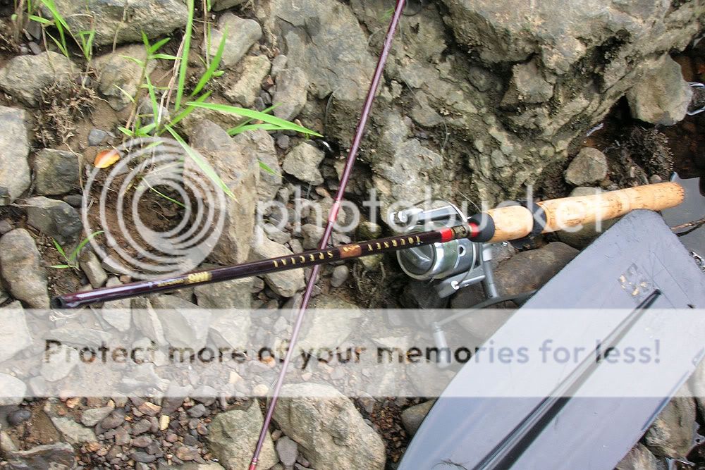
The river was exceptionally clear for several miles below our put-in. It reminded me of the the upper Chattahoochee or of the Caney Fork here in Tennessee. We meandered along and fished and chatted and just fell into the relaxed rhythm of the river. We'd hoped to catch some striped bass on this trip; an acquaintance of Darin's caught a 43-lb'er just upriver the week before. However, catches both days were limited to a few bluegill and a number of smaller bass. While the weather was superb, it's likely that the cool front put a damper on the fish bite.


On occasion, the river sped up as we passed through fish weirs, rocky V-shaped traps that Indians in the region used to collect food. Paddling went smoothly save for one incident with a Wilderness Tarpon, a jutting log, a moment of inattention, and a pinned leg and kayak. To Darin's credit, Jimmy said he rode the boat down like a good captain, but alas, before he was able to right the ship, he lost a rod, a rod holder, and his sunglasses. If anyone finds a pair of sunglasses on the bottom of the Etowah, please respond here with your email address. There may be a small reward involving Hawaiian Shave Ice.


CAMP
We cut our first leg of the paddle a tad close, getting to our camp island at 9 p.m. or a little after. At our site at 34°10'40.85" N & 84°54'54.85" W, a small clearing and fire pit marked where numerous people had sheltered before us, and we were fortunate in three respects. First, the island wasn't already occupied. Second, James found three nice logs from a tree that had been felled and sectioned. Third, there was still enough light to haul kayaks up a rise, pitch tents, collect wood, and establish a fire. Darin brought a small grill grate, and we cooked over coals drug from what turned out to be a nice campfire. Table fare varied from steaks to brats to whatever it was that Mike ate. Clearly, the Improvising Camper Award went to Eric, who sat on his daughter's "Tot Spot" chair and who slept diagonally in his daughter's tent on top of his wife's yoga mat. Purportedly naked. With a machete.


A few camp meal notes follow:
- For dinner, I pre-cooked a baked potato, smothered the outside in butter and kosher salt, wrapped it in foil, and then vacuum sealed it. It was absolutely delicious after being warmed up on some coals. A perfect complement to my ribeye.
- Cliff Bars rock. I just wish I could find them cheaper.
- I was solidly impressed with two other food items in particular. The first was Mountain House's freeze-dried scrambled eggs. With the ham and peppers, it was a pretty decent omelette in a bag. The second was the single-serve packet of Nescafé Taster's Choice instant coffee. Both items were easily portable as well as tasty. I'll carry them afield again.
- I vacuum sealed some raspberries, strawberries, and blueberries for breakfast, but by morning, the raspberries and strawberries had broken down into more of a compote consistency. They were still good, but obviously, blueberries travel better.
DAY TWO
The next morning, the Frosty Camper Award went to Michael, who only brought a sheet despite a warning about the cooler temps. He could be found shivering under towels by the campfire. Mike's saving grace was his government training; without a doubt, a less skilled man would have succumbed to the elements. Luckily, we still had some nice coals and, after stoking the fire with the remnants of wood, we gathered around a small blaze while preparing and eating breakfast.


We cleaned up the campsite, packed up the kayaks, buried the few remaining coals, and set off on our 7-mile leg. Eric, on a borrowed lure (make that a stolen lure), hung a nice little bass before we'd even gotten past the island. Turns out that fish, at a massive 14 ounces, would win him the Big Kahuna Award, a prize established in 2002 that rotates to the big-fish angler at various camping/fishing trips. As soon as he sends me cash for my Rapala, I'll be mailing him the trophy.


Past the island at the northern pinnacle of a long south-to-north stretch of the river, we hung out for a while and fished at Hardin Bridge. Designated as an historic bridge, this platt-through-truss design was built in 1930 by Austin Brothers Bridge Company. A pretty bridge, no doubt. Mike even beached his yak and hiked up to take a few pics from the bridge's deck.


The penultimate section of our paddle featured a river strewn with boulders and rocks. Picking our way through the outcroppings and trying to choose the best routes made for interesting paddling. We experienced a few stuck boats and a bit of bilge pumping when a sideways tip allowed water inside a cockpit, but overall, we made it through quite well. By the time we entered the home stretch, however, the river had widened and slowed and only offered the occasional set of rapids.


At the very end of the paddle, when it was pretty clear no one was going to top 14 ounces, I got a shot of Eric with his yellow, rubber, Eagle Claw rod that I believe he chose only because it matched his boat. The big shit-eating grin is indicative of the fact he'd already planned out a spot in his office for the Big Kahuna plaque. Ladies and gentlemen, I give you The Big Kahuna for annual year 2009.

A few gear notes here before the last act:
- Though Mike "pack mule" Dunn was impressive, the real work horse was the Pamlico 100. Between fishing gear and camp tools, I probably took 10 to 15 pounds too much stuff, and the Pamlico handled it like a champ. The back hatch was stuffed with five dry bags; the nose had a dry bag and a tackle box; and the bow held a Seattle Sports kayak cooler. The boat rode plenty high and the bow/stern handles were up to the weight.
- The aforementioned cooler did a nice job of keeping my cold food items cold. Darin froze a few bottles of water for me, and that was all I needed to keep my dinner from spoiling. That night and next day, I drank the water. Darin packed out my plastic.
- The MSR Pocket Rocket isobutane stove boiled multiple batches of water in quick succession without a hitch. Jimmy used a less expensive version bought at Wal-Mart with equal success. Aside from the problems with recycling the fuel canisters, these small stoves offer a lot of output in a relatively small package.
- The Camelbak water bladder is just a smart way to transport water for camping. Mine was a handy reservoir for cooking duties in particular.
CODA
Our drive from the woods at the take-out was an experience all unto itself. Instead of writing a short story here, I am just going to attempt a narrative collage of descriptive phrases. James, I'm glad you hung on tight.
Acura MDX. One trailer. Six kayaks. Seven passengers. "Are you sure we can go that way?" Mud-filled ravines. Leaning vehicle. Heads shaking. "I think we can do it." Spinning wheels. Muddy kayaks. Jerky starts. Heads shaking. Nervous jokes. A big surge. Mid-air vehicle. Trailer off hitch. James on hood. Mud down below. SUV in motion. Unstuck. Relief. Trailer reconnecting. Route retracing. Heads re-shaking. "Would you mind moving your Tahoe?" Youthful driver. Full reverse. Wrecked Tahoe. Collective groans. Heads shaking. Giant hump. Uncomfortable scraping. Nervous laughter. Rattling trailer. Heads shaking. Two humps now. Theory of momentum. Gritted teeth. Grating noises. Grinding scrubs. Gasps and grimaces. Heads shaking. "Ouch, that was the transmission." Paved road. Sweet freedom. |
Subscribe to:
Posts (Atom)