Showing posts with label Harpeth River. Show all posts

Monday, March 12, 2012

Harpeth Overnighter

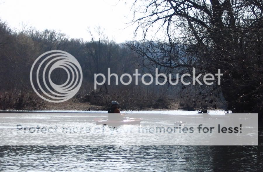
Six kayakers from three states convened at the Harpeth River on Saturday for a 30-mile, overnight float. Because of heavy area rains, the river had crested at 7.76 feet, started down, and then started back up again. We watched the hydrologic graphs with some trepidation, fearing the river would shoot up to the predicted 10+ feet. Thanks (we think) to the friendly guy down at Cheatham Lock, the river never got that high, and by the time we hit the water at Newsom's Mill, the Harpeth level was under 7 feet. It was still high and moving briskly, but not nearly as "flooded" as the folks at Tip-A-Canoe would have us think. Our ultimate destination on day one, 20+ miles downriver, was the Highway 70 bridge and the campground at Tip-A-Canoe.


Right out of the gate, Mike tested the muddy brown waters and pronounced them cold but fit for paddling. Fortunately, we had a temperate day perfect for an outdoor excursion. The sun was shining, trees were beginning to put on spring foliage, and critters were stirring. Wildlife sightings on the first day included ducks, geese, a fox, the occasional leaping fish, a couple of red-tailed hawks soaring on an updraft, numerous turkey vultures, and a lost brown bat that apparently thought it was nighttime. At about the 13-mile mark, we took a short island break for lunch, which included deviled ham wraps with Cheez Whiz and drive-through condiments. Julia Child, eat your heart out.

Our small cadre of kayakers included Mel, a first-time paddler from east Tennessee who pretty much smiled the entire day. "It's like having a recliner on the river," she noted in between grins. Mel paddled both days like a champ, taking whitecapped rapids in stride. In the video below, she's the last paddler deftly handling some rougher water.


We got to our take-out about an hour before dusk, and Kay decided to make sure the waters were still okay. Still cold, she determined. But nevertheless fit for navigation. The Tip-A-Canoe camp site held a good fire ring but not enough room for all our tents around the fire. So Moose and Mel pitched a tent nearby while the rest of us set up on the flat road entrance to the site. Thereafter, Moose worked hard at scavenging driftwood from a nearby pile-up, and Randy, Mike, and I hauled the wood up to the fire ring. We wound up with a sizable blaze, and after waiting an hour or more for coals to develop, Moose cooked up some excellent ribeyes for a few of us. Other table fare included tinfoil hot dogs and Kay's tasty pasta dish with olives and sun-dried tomatoes. As with any good campfire, we shared stories till exhaustion set in, occasionally pausing to ask, "Hey Mike, you want some corn liquor? It's strawberry."

Harpeth Overnighter Day One


Above is the GPS capture for day one. With the river up, we averaged almost 4 miles-per-hour, even with stops. Also notable is the roughly 9-mile stretch between Hidden Lakes and Highway 249. I had never paddled that section before, and while its subdivisions and I-40 crossings are not my favorite parts of the river, the portion does complete a personal 50-mile river consecutive run—from a put-in down by Old Natchez Trace up to the Harris Street bridge. On day two, my GPS crapped out after an hour. (Note to self: you get what you pay for with $1/pack batteries.) But our route, Highway 70 to Harris Street Bridge, was already familiar, and with its impressive cliffs that loom over sections of the river, it is still my favorite section to date.

Toward the end of the trip, while paddling in the lead, I totally spaced out and zipped past the entrance to the Montgomery Bell Tunnel outflow. While Randy and Kay veered into the creek-like detour in time, the rest of us beached on a sandbar downstream, and Moose, Mel, and I chose to paddle back upriver thirty yards or more against considerable current. Once again, kudos to Mel, who showed considerable moxie in her upstream paddle. It helped that she thought we'd missed our take-out! The reward? Some bragging rights and few shots near the Narrows waterfall, which I captured up-close in some video below.

Saturday, December 3, 2011

Harpeth in December

Team Essence, middle Tennessee's premier sea-kayaking team, hit the little boats today for a December run on the Harpeth. We watched the river gauge all week and decided to pull the trigger when water levels at our planned put-in stayed above 2.5 feet. Right out of the gate, my kayak scrubbed bottom, but from there, we had clear paddling for the next 12+ miles. Our trip took us from the Highway 100 bridge northwest to the Hidden Lakes access. Along the way, we navigated a few rapids (see video below), but for the most part, the river offered up a calm, steady flow. The scenery, on the other hand, was less tranquil at times since the river path passed through urban sprawl and alongside busy thoroughfares. Nevertheless, we completed one more Harpeth leg in the area, and the missing link is now the roughly 9-mile portion from Hidden Lakes to the Highway 249 bridge. If we are able to make that trip soon, we will have paddled a contiguous 50-mile stretch of the Harpeth.


Harpeth in December

Sunday, September 11, 2011

Harpeth Narrows Loop

Yesterday, I took a break from work to rendezvous with some Kentucky friends for a quick paddle around the Harpeth Narrows. The weather and water were perfect, and we enjoyed a temperate beginning-of-fall day with Harpeth water levels right around 2.5 feet. My companions launched at the Highway 249 access, and I timed our meetup at the state-park pretty well. I paddled up-river about a half mile, and there they were. It was a fairly busy river, but people were nice, with the exception of one frustrated soul who probably should have stayed home and watched football. At the end of the float, we paddled up the inlet to the lower side of the Monty Bell tunnel and took a few pictures. All in all, just a fantastic day on the water. Well, except for the snake my friend thought I wanted to see up-close. They must have different attitudes about snakes up there in Kentucky.

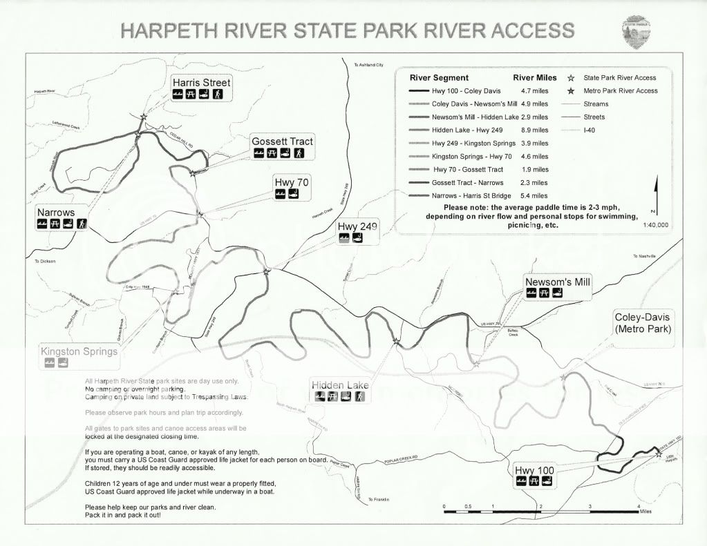
As we were doing final pack-up, a park ranger came by and distributed some river access and mileage maps that are currently in process. Eventually, a color-coded and updated version of the map will be available on the Harpeth State Park website. The version below enlarges in a separate page when clicked.

On the way home, I scouted both the Hidden Lake access and the Newsom's Mill access. Both have large, well-kept parking lots that open at 7 a.m. and lock around 7 p.m. And both require about a hundred-yard portage to get to the water, but the access points to the river are quite good. We may do a future overnighter from one of these put-ins.


Harpeth Narrows Run


Photobucket

Sunday, October 17, 2010

Low and Slow on the Harpeth River

(or)
Advanced Technical Draddling: A Style Primer


Jimmy and I knew the Harpeth was low. It has barely rained in middle Tennessee in more than a month. Still, after two decent rainfalls in the past week, I pushed for a Harpeth run yesterday morning. Turns out though it was less of a run and more of a drag. Or draddle, which is our newly coined portmanteau combining drag and paddle.

We retraced a route taken back in June of '09, and right off the bat, I feared we were going to have a repeat of the infamous draddle on the East Fork of the Stones a couple of years back. We didn't get a mile before the low flow necessitated an exit-and-drag maneuver. But then for much of the ~8.5-mile float, we managed to stay in our yaks—occasionally scraping bottom but managing to keep forward motion.

Hwy 249 to Hwy 70 on the Harpeth


Toward the end of the float, however, low current led to some pretty decent draddling. To avoid walking, we practiced techniques such as the paddle pole, the booty scoot, the bobsled, and the ever popular school of momentum. Still, we had to exit and drag in some stretches, and our two-hour float turned into 3.5 hours. Jimmy has since located hydrologic data for that section of the river, and using Saturday's level (1 foot) as a reference point, we should be able to avoid future draddling on the Harpeth.


Wildlife sightings included a fox squirrel, gobs of turkey vultures, at least four huge red-tailed hawks, and two coyotes. The 'yotes popped out of some tall grass next to a river bend, eyed us for a few seconds, and then trotted off downstream. I only captured the tail-end of one coyote with my camera, but Jimmy snapped a nice picture of both.

GEAR NOTES

Just a couple of items worth mentioning...
  • I tried out my Seals spray skirt on the Perception Swifty and found it to be a good fit. It should be a valuable addition in cold and/or rainy weather and in active current where splashes are more likely.
  • Soon after executing a draddle during which I tucked my GPS into my life vest, I looked to my right and saw a familiar pouch floating down the river. It contained, of course, my Garmin GPS, and I can now say with confidence that I appreciate the buoyancy of the dry pouch—a Seal Line "See Pouch." Without it, my Garmin unit might still be somewhere in the Harpeth.


Thursday, May 27, 2010

May Harpeth Float

Click graphic to enlarge.
Though I had planned to paddle more this month, Mother Nature had other ideas. May brought torrential rains and flooding to middle Tennessee with two-day totals coming close to 20" in some areas. Sections of the state experienced 1000-year floods, meaning that the rainfall totals had only a .1% chance of occurring.

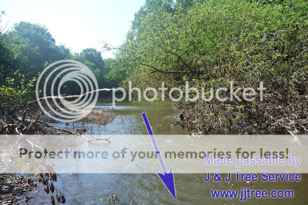
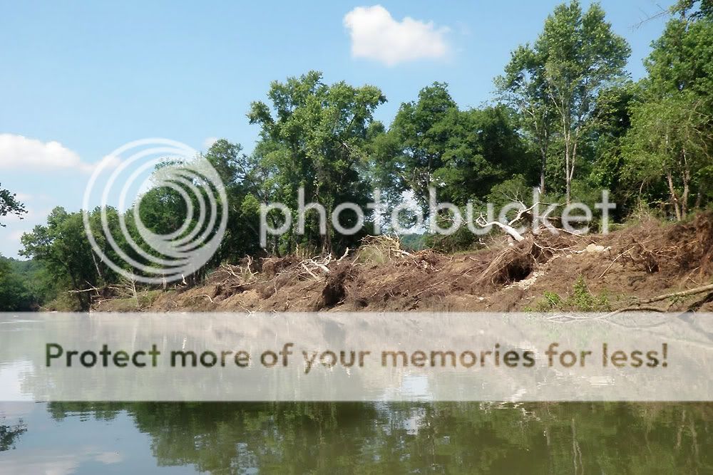
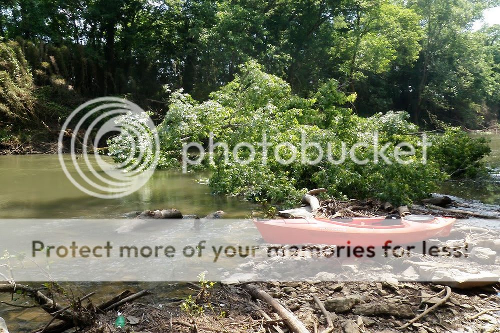
All the rivers in this part of Tennessee, including sections of the Harpeth River, broke longstanding records for flood levels (see link in previous paragraph), but by the time Jimmy and I got down to the Harpeth today, the river depth had returned to normal. Still, in the stretch we paddled near Franklin, the river had crested above 35 feet, and we saw plenty of evidence of the flood's effects. Trees were down across the river in several spots, and we spent some time with a folding saw clearing limbs from one that had fallen up against a sand bar. In addition, Sneed Road Bridge was under repair due to flood damage, and in the wide portion of river just beyond the bridge, the river was almost completely dammed by flood debris. We passed by a blue wheelbarrow dangling from limbs nearly three stories up, and one section of riverbank appeared entirely washed out.

Click pictures to enlarge.
Photobucket Photobucket

May Harpeth Float


Above is the GPS capture of our trip from my Garmin handheld. We covered 10 miles in about 4 hours and 20 minutes. That time included stops for portaging, fishing, and clearing tree limbs.

I didn't fish much but caught a couple of lively bream. Other wildlife we encountered included several geese cooling off in the river, a deer bounding along the river bank, and a large owl flying down river. The owl lit momentarily in a riverside tree branch, and I tried unsuccessfully to snap a picture before it flew.

There were also some phantom beasts. The construction crew at Sneed Road Bridge tried to put one over on me by shouting about "poisonous snakes" in the downed trees I portaged. I laughed it off, but I was actually concerned with the abundant poison ivy lining the river bank where I needed to put my hands.

Photobucket Photobucket

Jimmy's report of the trip can be found here, and his photos from the float can be seen here. It should be clear that I have blatantly stolen some of his photos without copyright permissions.

With my new camera, a Panasonic DMC-TS2 (review forthcoming), I captured some HD video of the river. If you choose the 720p option in the YouTube clip below, you get a sense of the camera's video capability.

Saturday, January 23, 2010

Raging Harpeth

Well, maybe not quite raging. But definitely full. "All swoll up" if you prefer a more rural parlance. Despite the high waters, Jimmy and I decided to head to the Harpeth today and float from the Highway 70 bridge down to the Narrows take-out—a trip of just over ten miles. This route took us right through the center of Mound Bottom, a prehistoric Native-American site with ceremonial and burial mounds that are visible from the river.

Harpeth - Hwy 70 to Narrows


At first we thought put-in was going to be a muddy bank affair, but it turned out the water was so high that it formed a perfect, still pocket next to the bridge pylon. Normally, that rocky area is well above the river level. Also out of the ordinary was the small creek that empties into the Harpeth just next to the put-in. The river was backed up so far into the channel that we were able to paddle up the creek a hundred yards or so and explore beyond the Cedar Hill Road bridge.

Click pictures to enlarge.
Photobucket Photobucket

A few miles into the trip, we were treated to a bald eagle perched riverside in a tall hardwood. It flew down the river in front of us a couple of times before finally letting us pass by. With my little point-and-shoot on full zoom, I managed to snap several pictures of the majestic creature, which was obviously a mature bird with its bright white head and tail feathers. Several years ago, I visited Reelfoot Lake in northwestern Tennessee and saw both adult bald eagles as well as the more mottled juveniles. Other than those resident birds, I've only seen three other bald eagles in the wild, including today's sighting.

Photobucket Photobucket

In addition to the eagle, we spotted numerous herons fishing the banks of the river, several turkey vultures/buzzards circling over one area (never a good sign), and two hawks soaring further and further into the sky on an updraft. In a couple of spots, large swirls near Jimmy's boat marked where fish, most likely carp or gar, were startled by the sudden presence of a bright orange kayak.

Photobucket Photobucket
PhotobucketPhotobucket

The trip was a quick one since the river was up and moving fast. We covered 10.2 miles in just over two hours, averaging 5 mph. According to Jimmy's GPS track, we hit speeds well over 10 mph in some spots—probably stretches where we were shooting a narrower neck of the river.

The average speed would have been even faster, but our time afloat included stops for two side excursions. In addition to exploring the creek next to the put-in, we also paddled up to the waterfall at the Harpeth Narrows tunnel. Water was gushing out of the rocky opening, and we spent some time paddling up into the frothy current and then surfing out.

I captured a quick video of Jimmy battling the rush of water. With the sound turned up, you get a pretty good sense of the roar created by the spillway.

Friday, June 12, 2009

Kingston Springs Float - Hwy 249 to Hwy 70


Well, my kayaking friend and I knew we weren't in Kansas anymore when, while dropping one vehicle at the take-out, a passing car blew its horn and strains of Dixie came out à la The General Lee on The Dukes of Hazzard. Our rustic whereabouts were further confirmed when I parked my truck next to an SUV with an aluminum arrow for an antenna.

Photobucket Photobucket

We listened hard for banjo playing at the put-in, but when all was silent, we decided to proceed with caution. The river access at Highway 249 is quite good with a clear shallow slope down to the river just by the bridge. As we started downstream, we crossed under a railroad bridge and then ran parallel to Highway 70 for a while before turning south.

Harpeth Hwy 249 to Hwy 70 at EveryTrail

Map created by EveryTrail: GPS Trip Sharing with Google Maps

Our paddle was a roughly 8.5 mile winding path with two long bends through the Kingston Springs area. I actually liked this portion of the river better than the Narrows. The scenery is terrific with just as many high cliffs, and in my opinion, there are better slow stretches with cover for fishing. Around the halfway point, the Kingston Springs City Park offers easy access to the river such that two 4+ mile paddles are easily do-able in this portion of the Harpeth.

Photobucket Photobucket
Photobucket Photobucket Photobucket
Photobucket Photobucket

After last Sunday's Harpeth float, I had hopes of catching more smallmouth and even went so far as to research good lures and make a few purchases. However, because two strong rainstorms came through yesterday, the river was up and dingy, and I wasn't very confident about catching a lot of bass. I started out throwing a Heddon Tiny Torpedo on topwater. Nothing. Then I switched over to a chartreuse Slider grub on a jighead. Not a bite. The 1/4 ounce white Rooster Tail? Zilch.

Finally, I went back to an old standby, the Rapala Countdown in silver. I've used the CD-01 for years to catch stocked trout in nearby streams, and I tied on a slightly bigger CD-05 to try and tempt a bass. It wasn't long before I had a strike. Not a bass, but a small catfish. A little while later, I hooked a bigger cat that put up a nice fight, and before the end of the paddle, I caught a smallish bream on the same lure.

In the final leg of the paddle, I took the time to grab a movie file with my camera. Photobucket, it turns out, makes it a piece of cake to post such captures here at Blogger. The .mov files are converted to .flv files during upload, and Photobucket offers a ready-made string of HTML for embedding the video.

Today's clip is not exactly high drama. Actually, after the first ten seconds or so, it's a little like watching paint dry, but I guess even Spielberg had to start somewhere. I can note though that this filmed section was one of the more prolonged choppy runs, and I was impressed by the way the little Perception Swifty tracked in the faster flowing water. I only had to dip my paddle once to keep the bow pointed in the direction I wanted.

Monday, June 8, 2009

Harpeth Narrows


Floated and fished the Harpeth Narrows yesterday with a buddy. A great thing about the Narrows float is its simplicity. Since the river bends around to form a roughly 5-mile circle, you can do the float solo. A short hike from the take-out puts you right back to parking at the put-in. With a truck, it's easy to just toss a kayak in the bed, and within an hour, I can be on the water.

Photobucket Photobucket

Harpeth Narrows at EveryTrail

Map created by EveryTrail: GPS Community

For the second time, we paddled our kayaks up a small channel that leads to a waterfall, its spillway tunnel connecting the closest portion of the Narrows. About this landmark, the Tennessee Encyclopedia of History and Culture notes:
The Patterson Forge, the site of which is now preserved at the Narrows of the Harpeth State Historical Area, was constructed at the neck of an unusual bend of the Harpeth River where, after approximately four miles, the stream channel returns to within two hundred yards of itself. Around 1818 Montgomery Bell purchased the site, which at the time was in Davidson County. Soon after, African American slaves under Bell's direction began excavating a tunnel through a one-hundred-yard-wide rock ridge that separated the river beds. Designed to convey water for power, the tunnel was completed by 1820. Following a failed effort to sell the site to the United States government for construction of an armory, Bell erected a forge for the production of wrought iron, using pig iron from regional blast furnaces.

Montgomery Bell owned and operated Patterson Forge from 1832 to 1854. After this, James L. Bell ran the operation until about 1862, when it was closed during the Civil War. The forge was not reopened after the Civil War because the iron industry in Tennessee, in general, remained depressed. In the 1880s a gristmill was established on the site to take advantage of the water power provided by the tunnel.

Today the Cheatham County site of Patterson Forge is part of the Narrows of the Harpeth State Historic Area maintained by the Tennessee Department of Environment and Conservation. The site and the nearby grave of Montgomery Bell are silent reminders of one of Tennessee's important early industries.

Photobucket Photobucket

Casting a 1/16 oz. Rooster Tail all day, I caught and released over 30 fish, including catfish, bluegill, sunfish, rock bass, largemouth bass, and smallmouth bass. Big fish honors, however, went to my friend who caught a nice 15" smallmouth. On ultra-light tackle, all these fish were fun to catch, but the bigger smallmouth put up an especially good fight.

Photobucket Photobucket

I'm always amazed by the iridescent coloring of the little longear sunfish that populate streams and rivers in Tennessee. They look nearly tropical. Besides the fish that we caught, wildlife we saw included beaver, fox squirrel, great blue heron, gar, lots of large carp sunning in the shallows, and a softshell turtle.

Photobucket Photobucket

Saturday, March 21, 2009

Spring Harpeth Float


I mentioned a couple of posts ago that I've gotten back to the river.
Back after a long break. From the time I was 14 and could drive my father's truck to the Little Tallapoosa until I was 17 and leaving home for college, I spent a lot of long, lazy, summer days on a stretch of water below my grandmother's house. Fishing, canoeing, wading, and thinking. Since then, I've visited rivers once in a blue moon, but mostly, they became lost amid the shuffle and chaos of life. I did not realize quite how much I missed them.

Last year, some twenty-plus years later, I gave into an impulse and picked up a couple of small kayaks for river floats. I've since found there is no better fishing than with a kayak, a paddle, a small rod, and a select kit of tackle. Yes, there's fishing that's simpler; I've wet a line with a cane pole from the bank many times in my life. But the kayak mobilizes you and puts you in spots where the fish live. You can slip in stealthily and cast to places that would be impossible to reach from shore. This summer, with the little yaks, I'm looking forward to floating and fishing several of middle Tennessee's rivers.

Photobucket

Yesterday, a friend and I did a run of the Harpeth River from Highway 70 to the take-out just past the Harris Street bridge. No fishing as the water level was way up, and we wanted to see how quickly we could make this roughly 9.5 mile run. It would up being just over two hours. Averaging nearly 5 mph in the smaller boats meant swift water, and this condition was a stark contrast to some of the very low water levels we experienced at the end of last summer. Only one spot--a set of rapids where the river runs alongside the road--gave us any pause, but the kayaks handled the swells quite well. The trick seemed to be taking them at a slight angle and letting the boat simply bob over the crests. A spray skirt might have been useful here as some spray did enter the cockpit.

I used my iPhone to capture the float with an app called EveryTrail, a kind of log-book site for various GPS data captures. It worked nicely, the only exception being the elevation data, which is unreliable. One nice feature of the application is that it allows you to take photos along the way, and it "waypoints" these photos at the proper location along the track route.

Widget powered by EveryTrail: GPS Geotagging