
This past weekend, four of us trekked over to the Long Branch campground alongside the Caney Fork River, the plan being an all-day fish & float on Saturday and a shorter float on Sunday.  On Friday, I experienced the perils of speed packing at the last minute. With my inner Boy Scout shouting "You might need that!" at every turn, I threw way too much stuff into the truck, and of course, I forgot some of the essentials (think food here). Fortunately, the Lebanon Walmart Supercenter en route carried my favorite Mountain House freeze-dried pouches and a few other items I needed. After a stop for supplies and dinner, Mike, Robert, and I got to the campground with enough sun to spare and set up camp. The spot, campsite number one, was perfectly located. We were only about thirty yards from the boat launch, and a short walk down some steps gave us easy access to our put-in. The showers/restrooms conveniently sat right across from us, and the site featured a fair amount of shade during the day.
Later that night, I walked down to the boat ramp and cast a Rapala minnow blindly into the dark river. My head lamp didn't help because of the dense fog covering the water; visibility was probably three feet or less. Still, I managed to hook and land a nice 13.5" rainbow which turned out to be the biggest fish of the weekend.
DAY TWO - SATURDAY
The next morning, after we roused ourselves and had some breakfast, the three of us got kayaks rigged and ready, and then Robert and I headed out to drop my truck at the take-out. Mike kept an eye on camp. At the same time, Jimmy was driving over to Long Branch, and everyone was to congregate at the campsite by 10 and hit the water by 10:30 or so.
Click pictures to enlarge.


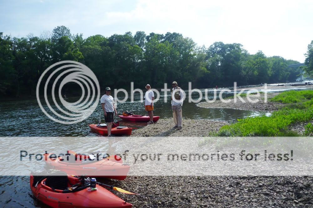
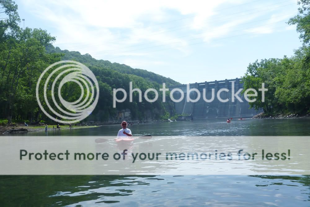
Robert and I passed up Betty's Island as a take-out and went in search of the Kirby Road pull-off marked on the Corp of Engineers map. On the way, we discovered that the bridge on Betty's Bend Road had been restored; just a year earlier, that bridge had been out. And despite a local telling me that Kirby Road was hard to find, it was in fact nicely marked with a street sign. The road was a one-lane affair and off the beaten path, but we eventually found a busy parking area just beneath the I-40 overpass where take-out wasn't going to be too difficult. We headed back to camp, taking the shorter route along Betty's Bend Road, and Jimmy timed his rendezvous nicely. After a bit of finagling and final rigging, we launched into the Fork.
Along with 100 other people.
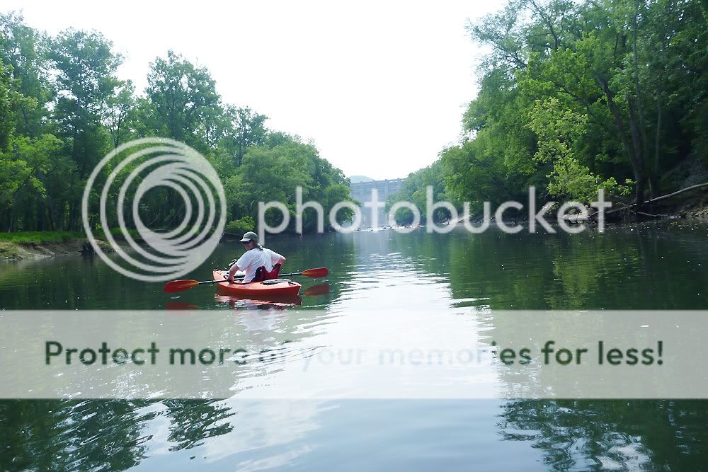
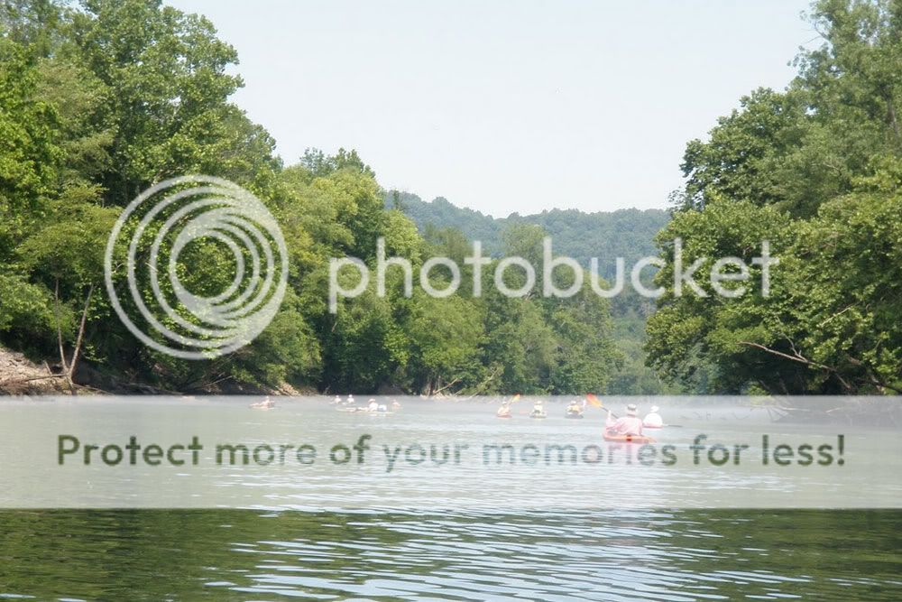
Well, maybe it wasn't that crowded, but it was crowded. "Disney on the Fork" is what I kept calling it. I felt sorry for the poor fly fishermen whenever a group of canoes or kayaks plowed right through their casting area, and I tried to be respectful with my boat's line. But with the throngs drifting together in one big polymer and aluminum armada, my efforts really didn't matter. 


One group of local color raised a continual ruckus in their canoes, and the snatches of conversation we gleaned were priceless. One memorable, cryptic line was: "Walmart ain't like Las Vegas." Now I sense that the utterance contains infinite wisdom, but I admit I'm still trying to decipher it. My first inclination was that it involves the People of Walmart website, but after more reflection, I'm convinced the line has deeper philosophical significance. Further downriver, another fellow was apparently practicing his standup act and shouting Little Jimmy Dickens jokes to two victims of proximity in a nearby canoe. Peaceful it wasn't, but the entertainment value was high.
At the Happy Hollow area around mile five where most folks were taking out, we noticed a storm brewing behind us, and we made a dash downriver to see how far we could get before it hit. It didn't take long. Mike and Jimmy sought refuge under some tree canopy and enjoyed a brief shower. Robert and I, on the other hand, benefited from lingering back a ways and found cover under the I-40 bridge just as the bottom dropped out. The deluge was short lived, and once we got under way again, we enjoyed a quieter, less populated river.

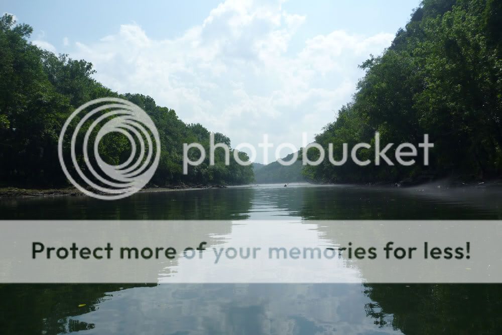

The last half of the float offered up an eerie, picturesque river often covered in fog. We had plenty of fantastic scenery. But what we didn't have was current. Launching after 10 in the morning, we had counted on the Center Hill Dam generation, which purportedly ran from 2 p.m. until 5 p.m. However, we didn't note any significant rise in the river until 6.5 hours into the trip as we stood on Betty's Island around mile 8. As a result, we were on the water longer than we thought we would be. Total trip time on Saturday was just over 7.5 hours, and we covered around 10.5 miles. The trip route can be seen in the GPS capture below.
Caney Fork - Day Two
Overall, we didn't have much luck fishing. I caught a couple of trout near the boat launch Friday night and Saturday morning. And in the upper stretch of our float, I added 6 more small trout (including 2 browns), 2 bream, and a tiny bass. In addition, I know Jimmy and Robert both caught fish, but the numbers and the sizes weren't great. The lower portion of our float past Happy Hollow looked superb in terms of cover, structure, water clarity, and water depth. I fished parts of it hard but struck out. Nada. Not one single fish in the last four miles. Just as we were about to take out, we passed a couple of guys tossing gigantic (10" to 12") plugs, and I confirmed that they were fishing for the big browns. But we didn't see them hook up either.
That night, back at camp, some of us enjoyed three-hour hot dogs. (Note to self: never again attempt to light charcoal briquets for food prep with a fire starter brick.) And we sat around and shot the breeze until everyone was exhausted enough to crash in the hot, humid weather. (Note to self: the box fan is always a smart move in the summer where electrical hook-ups are present. Score one for the inner Boy Scout.)
DAY THREE - SUNDAY
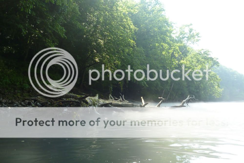
Next day, we arose, ate, tidied the camp, and then ran my truck down to the Happy Hollow take-out for a shorter five-mile-ish float. Once on the water, we again encountered pretty high traffic, and I was surprised we didn't witness someone hooked by a fly cast, either on purpose or accidentally. We almost did see some fisticuffs between two fellow canoeists, and in a few spots, we encountered more fog floating lazily over the water.


One fun part of the Sunday float involved taking the channels behind three islands in that stretch of river. Jimmy, Robert, and I ventured into the first one and contorted our way under a fallen tree only to find we needed to portage about ten feet to get across a shallow run of water. The next two channels, though shallow in places, were clear their entire lengths. Mike, Jimmy, and I explored the second one, and then Jimmy and I paddled the last one. These creek-like waterways reminded me of the run we paddled next to our camp island on last year's Etowah trip. Below are some pictures of the channels along with a GPS capture of my route.


Caney Fork - Day Three
2 comments:
Great pictures! I enjoyed reading about the trip. I didn't know you all had so much company along the float!
Just found you interesting and well written story. Always glad to help but sounds like you would have had a great time without it.
Next week I'm taking a self-sufficient group of tough Boy Scouts on their first 4 day kayak trip down the Etowah from Dawsonville to Lake Alatoona. Hopefully they will have as much fun.
Come back anytime.
Richard
Post a Comment